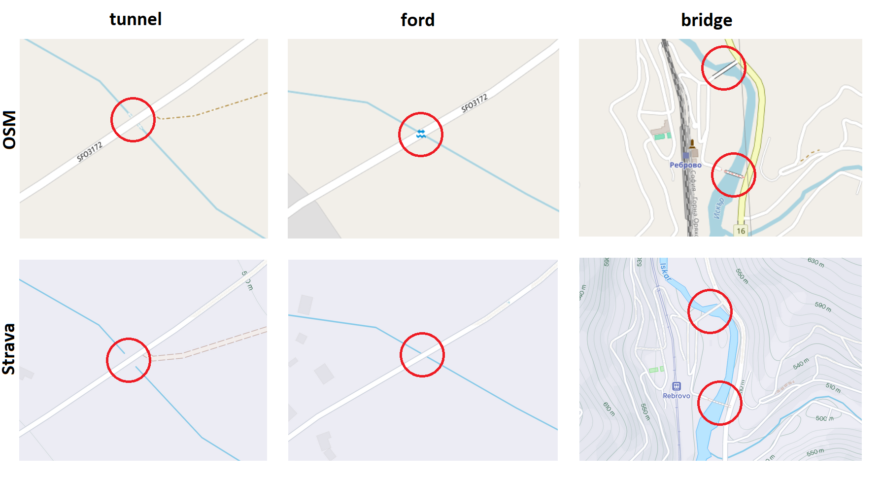
Currently, the maps in Strava do not provide detailed information about bridges on paths that cross rivers. In contrast, OpenStreetMap (OSM) includes these details, which are vital for users planning routes. Incorporating this information would greatly benefit cyclists, runners, and hikers, ensuring they are better prepared for their journeys and avoid potential dead ends.
Which details are you missing and why would they be useful?
Currently, Strava maps do not mark bridges on paths that cross rivers at all. Including this information is crucial for several reasons:
- Route Planning: Cyclists, runners, and hikers can better plan their routes, avoiding dead ends and ensuring they reach their destinations without unexpected detours.
- Safety: It enhances safety by providing clear information about river crossings, which can be critical in avoiding dangerous situations.
- Time Efficiency: It saves time by allowing users to choose the most efficient and direct paths.
These details are essential for accurate route planning and overall user experience. OpenStreetMap (OSM), for instance, includes such information, making it a valuable resource for users.
Additionally, Strava maps do not differentiate between tunnels, bridges, or fords. Often, when I plan a route, it is unclear whether a path can be crossed on foot or by bike. There are also instances where rivers become very full and impassable even by car when there is no bridge, i.e., it is a ford.
Here are examples illustrating the differences between OSM and Strava when a river goes under a road via a tunnel, when there is no tunnel or bridge (ford), and when a bridge is used for a large road and a small path.
Hello
Thanks for your post. We appreciate the feedback on how bridges are depicted on the map. I’ll pass it along to the Team. Thanks again.
Reply
Login to the community
Enter your E-mail address. We'll send you an e-mail with instructions to reset your password.