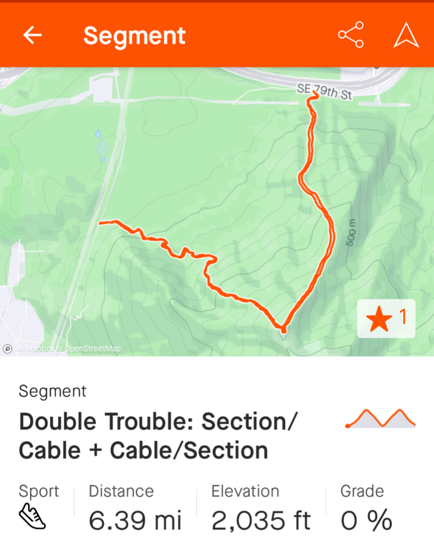
Currently Strava provides the following stats about each segment: distance, elevation, and grade.
The problem is that these stats are only valid if a segment is a straight uphill or straight downhill.
But if a segment has both uphill and downhill parts the stats can be wrong or even outright misleading.
Here a good example. The segment below takes one of the steepest trails uphill to the top of a popular local summit, then goes down on another equally steep trail, then turns around and ascends the second trail, then goes down on the first trail.
The segment description shows the grade as 0%, which couldn't be further from truth. It also shows the elevation incorrectly as 2035 ft. In fact this segment has about twice the elevation gain and the average grade is closer to 25%. So not only this segment stats don't provide correct information about the segment but also it won't likely come back in a search as a hilly segment.

I think Strava can do better than that.
I understand how Strava gets these elevation and grade numbers, so there is no need to explain that. My point is that showing the grade as the difference between the end and the start divided by the segment length isn't going to tell me enough about the terrain in between, so that isn't useful except in simplest cases. Also, calculating the elevation as the difference between the lowest and the highest point isn't useful when segments are longer and have more complex terrain. Perhaps this is an example of using segments for something completely different that Strava originally anticipated, but this isn't very unusual as far as trail running segments go. These kinds of segments are getting increasingly popular. They often mirror FKTs.


