cancel
Showing results for 
Search instead for 
Did you mean: 

Flag dangerous routing

dsm1891
Pico de Orizaba

Hello,

I understand you use third party services to handle your maps and routing, I just wanted to highlight Strava frequently suggests routes that are dangerous. Strava has the capability to flag segments as dangerous, but not if Strava built routes are.


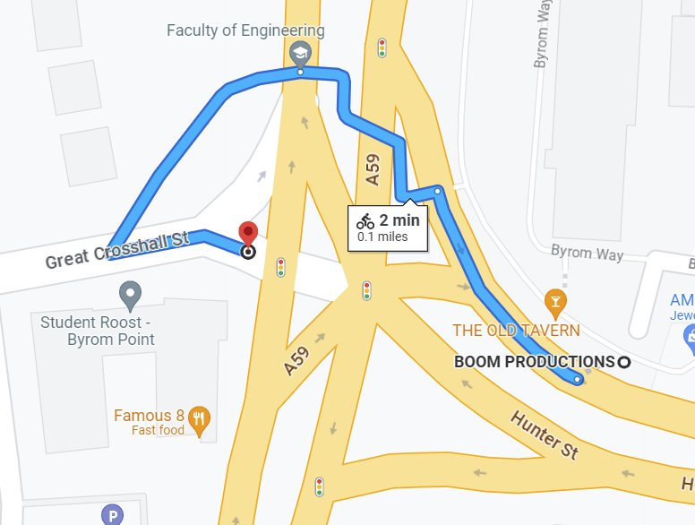
Here is the route strava suggests I take from Great Cross Hall Street to Hunter Street (Liverpool UK)

dsm1891_0-1691851883299.png

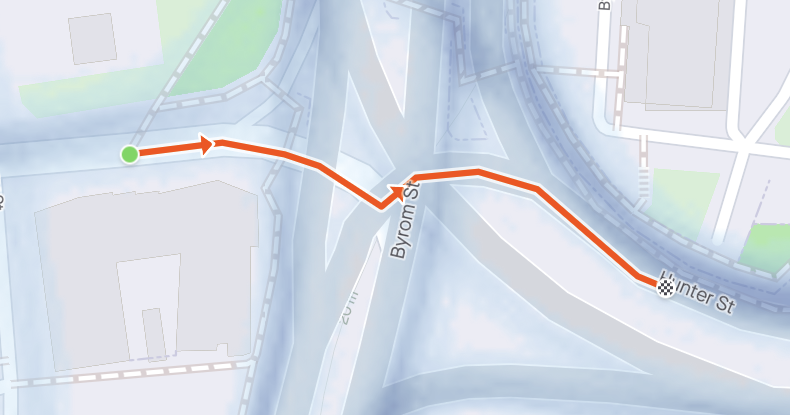
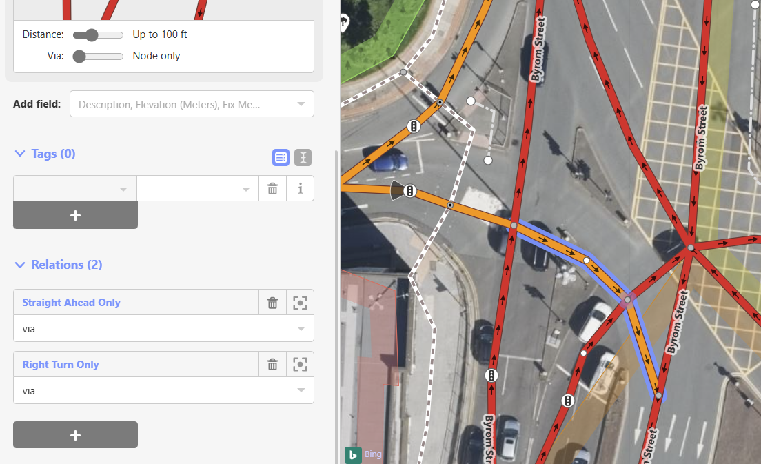
This is an illegal turn turning through a busy intersection on a major A road through the city. There is ample bicycle tracks around this area, however Strava routes across 4 lanes of traffic with each lane heading in a different direction.

I understand the map makes it look semi-possible to cross, but due to the lights and the (unsigned) right turn only in the middle, it is not possible.


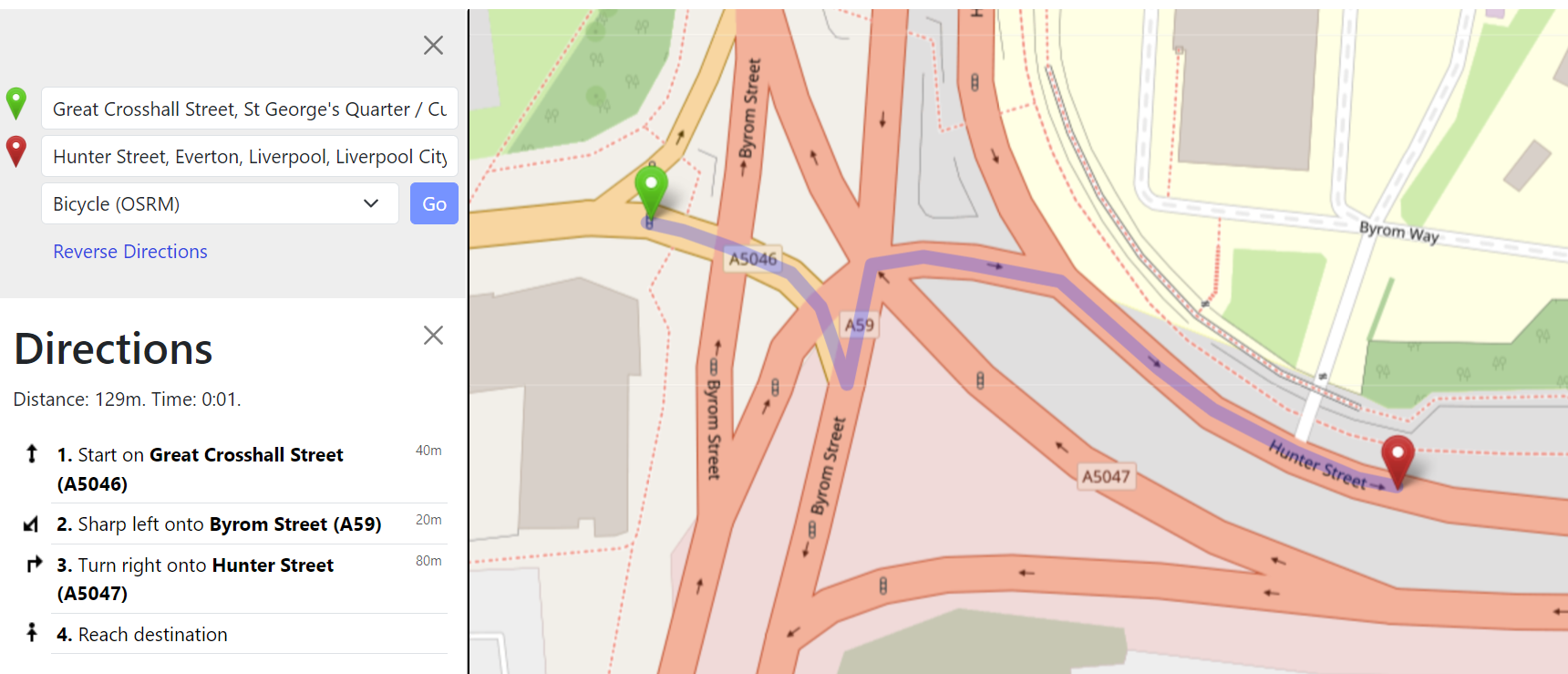
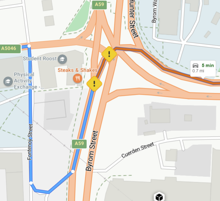
Here is how google routes it:
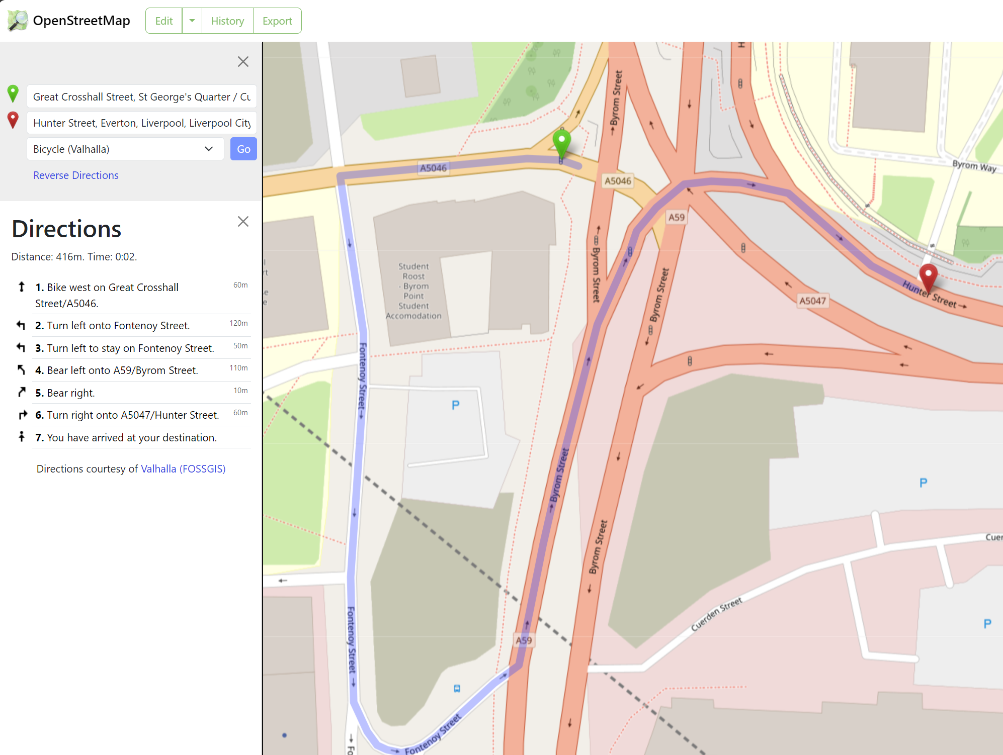
dsm1891_1-1691851983615.png

and bing (as a car)

dsm1891_2-1691852386112.png

Just trying to make our city a little safer. I would appreciate if you could flag this with your map/route providers and consider in-app ways of flagging this information.


Thanks 


4 REPLIES 4

Scout
Moderator Moderator
Moderator

Hello @dsm1891,
The static maps in the Strava feed and on the activity details page are provided by Mapbox, with the data for roads, places, parks, points of interest, and trails sourced from OpenStreetMap.

You can learn more about the Maps used on Strava, and how to make contributions, within our support article here: https://support.strava.com/hc/en-us/articles/216917717-About-Strava-Maps

If you believe there is data that could benefit from an update, we encourage you to visit OpenStreetMap to share your insights. 


Cheers,
Scout (she/her)
STRAVA | Community Hub Team

dsm1891
Pico de Orizaba

Hi Scout thank you for the reply.

The OSM is correct. However the OSRM pathfinding is not.

Here is OSRM pathfinding that strava seems to use

dsm1891_0-1699358805560.png


and here is the Bicycle(Valhalla), the legal and safe route on OSM

dsm1891_1-1699358035158.png

May I ask why Strava is using OSRM rather than Valhalla? 

Jan_Mantau
Denali

You should do the nessecary turn restriction adjustments in Openstreetmap to prevent this route. Strava will take that over after some time.

I do not understand how to use the software to make the change. 


dsm1891_0-1691923288550.png

it looks to me that the turn should be set up correctly (right turn only)