


Estimated Reading Time: 15 mins ⏲️
The final installment of the Tour Divide series features a personal story of the journey home.
Unspeakable Tragedy
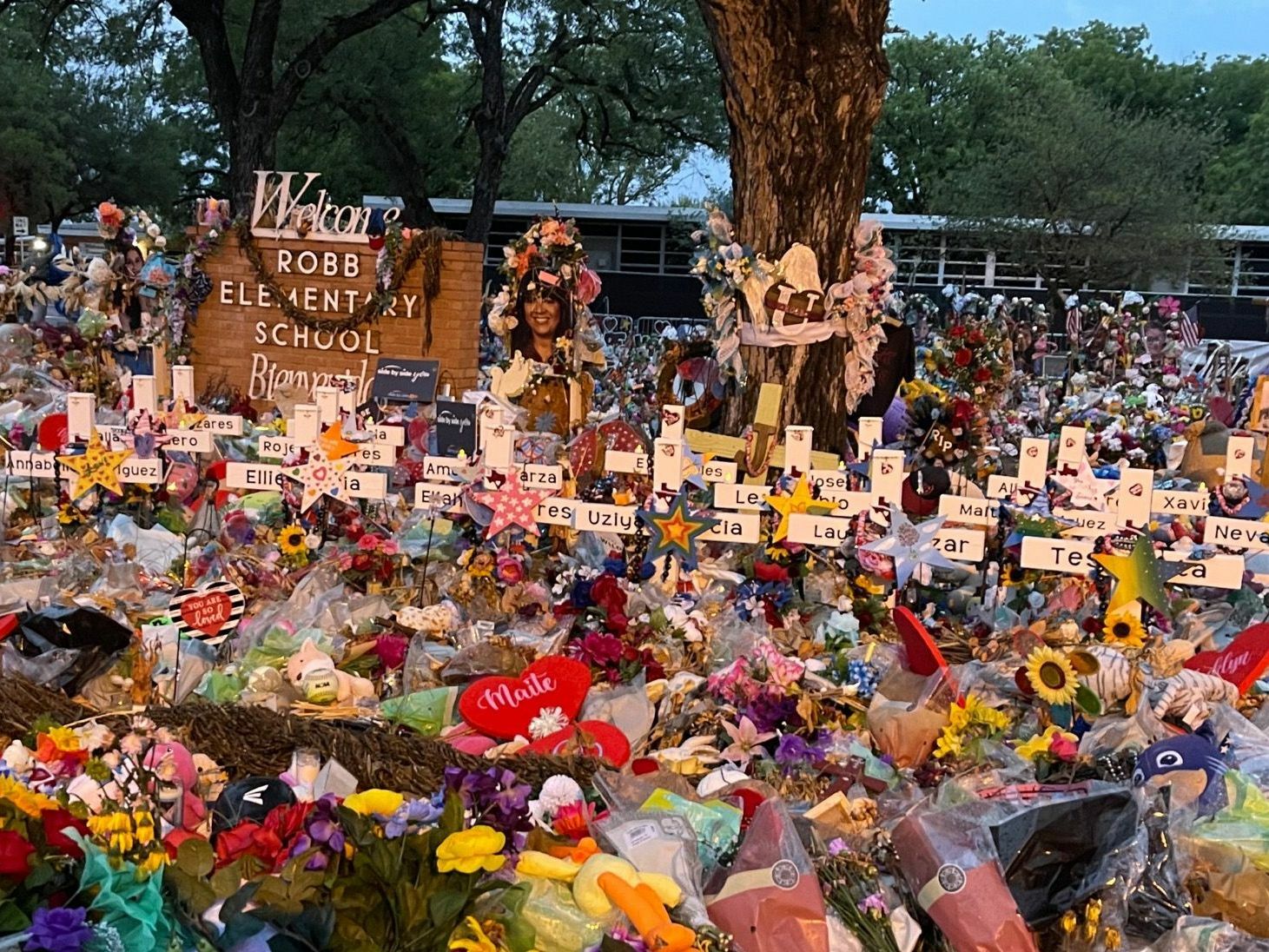
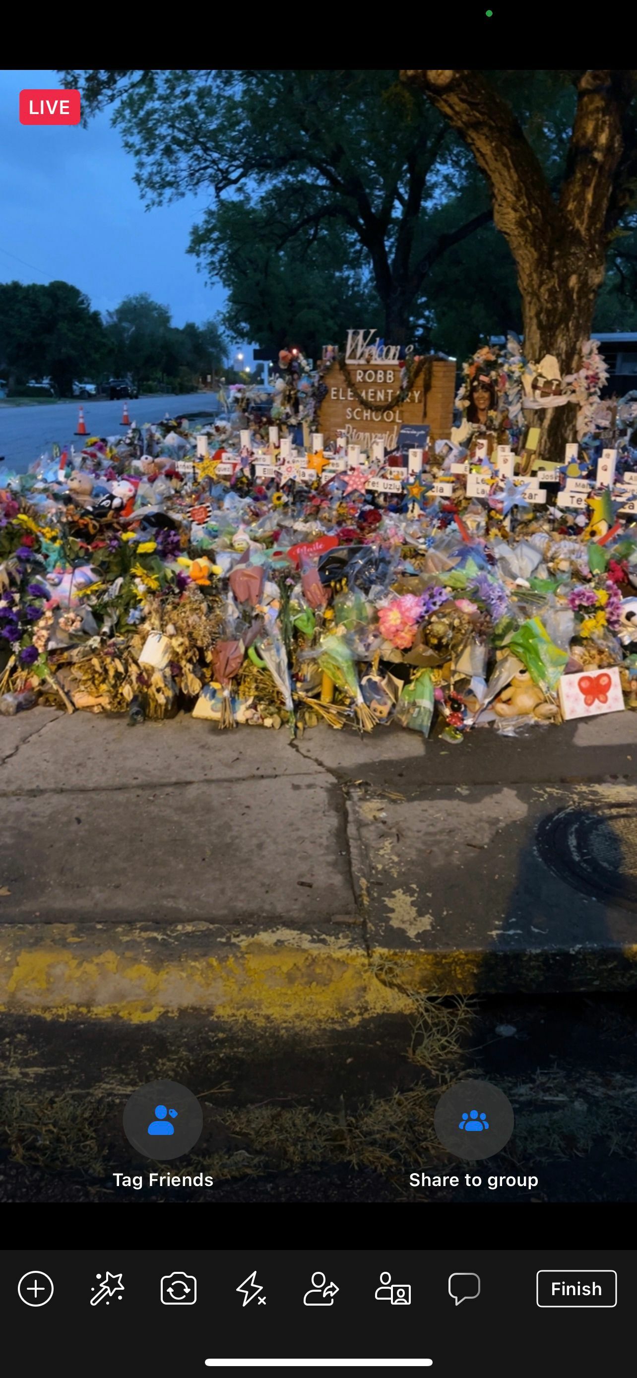
Uvalde, Texas. I stood in silence before the memorial with one foot still clipped in so that I could ride to see more of the impromptu memorial which had grown to wrap around the front of the entire school. I was Facebook live streaming, but I said nothing because I knew that I would start sobbing uncontrollably. The only sounds, instead, were birds chirping and then a sudden jolt from a canopy collapsing knocked over accidentally by a security guard who had been guarding the memorial over-night. How did I find myself standing here on July 3rd, 2022 about five weeks after gun violence claimed 19 more lives in the USA? Well, let's back up just a few days to June 28th, 2022 where I found myself standing someplace completely different...
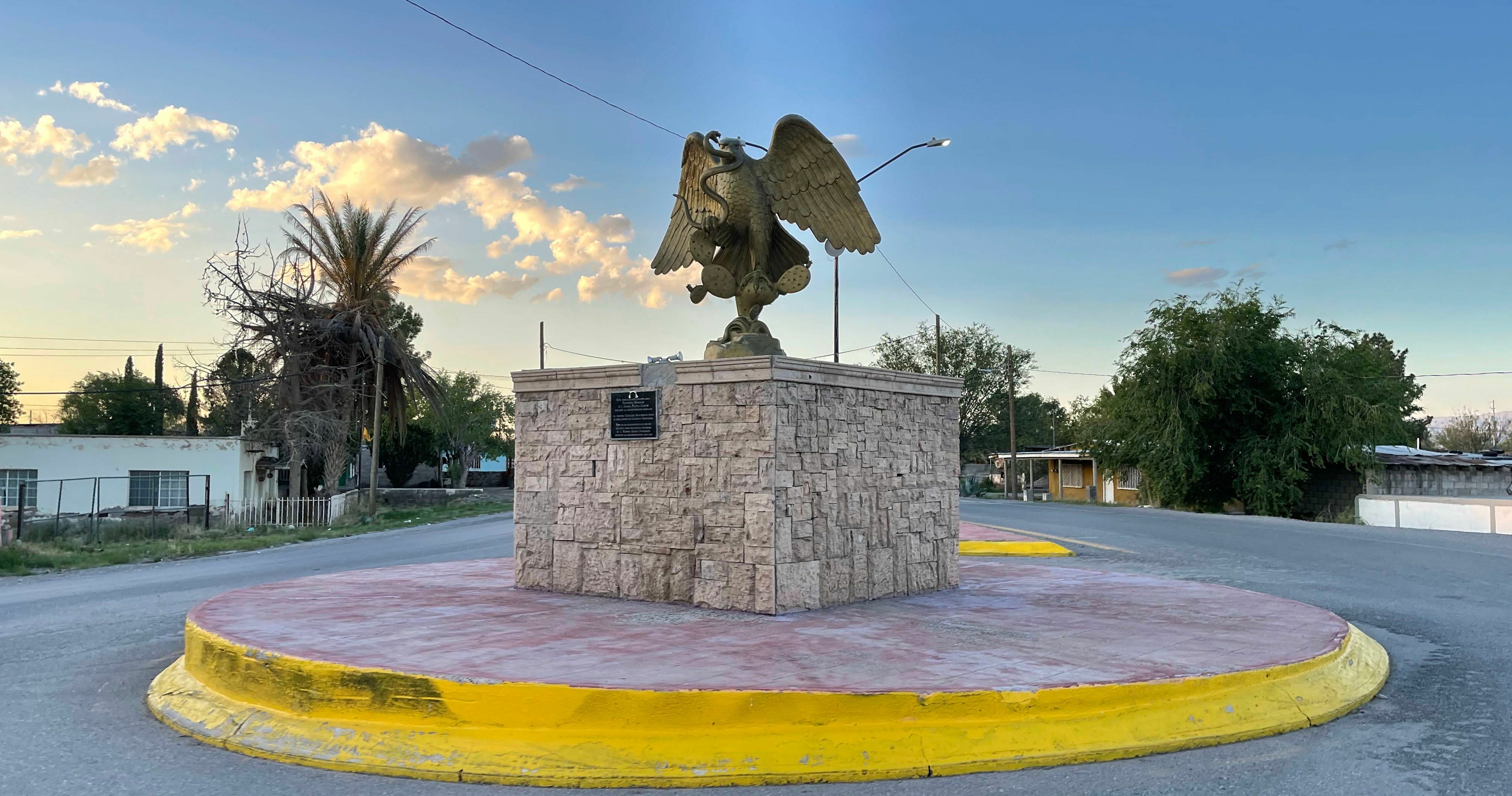
Antelope Wells, New Mexico. I stood at the least used border crossing between the United States and Mexico at 5:30pm on June 28th, 2022 about an hour and a half after it had closed for the day. This border crossing is the official end of the Tour Divide bikepacking race - a 2,715 mile race following the Continental Divide through two Canadian Provinces (Alberta and British Columbia) and five states (Montana, Idaho, Wyoming, Colorado, and New Mexico) crossing the USA from north to south. As a Tour Divide racer, you only have a 25% chance of arriving at the finish when the border crossing is open since it is only open for 6 hours from 10AM-4PM each day. While that doesn't matter for the official race, since the crossing itself is the finish line, it did factor into the adventure that I still had left - riding 1,800 miles from the finish line in New Mexico to my home in Alabama.
Navigating across the country via school shooting memorials
My planning for the Tour Divide was in full swing when the shooting in Uvalde happened on May 24th. I was already thinking about riding home, but this instantly "sealed the deal" as I knew that I would not only be riding home, I would also be routing myself through Uvalde, and I was dedicating the whole entire trip to the victims, their families, their friends, and their community.
Furthermore, as I biked across West Texas on my way home to Alabama via Uvalde, the Eminem song "Darkness" started playing on my phone. This song is about the Las Vegas shooting, but it transitions at the end to news reports from the 2018 school shooting in Santa Fe, Texas "just outside of Houston". So I decided right then while riding in the high desert of West Texas to alter my route in East Texas to make sure I visited the Santa Fe High School, too.
The Tour Divide itself is a daunting challenge. This year's weather made it even more extreme than usual. I recap my experience in Part 1: A Tour Divide Adventure. Even getting to the start was an adventure, and I recap that in Part 2: A Tour Divide Adventure along with my background as a cyclist leading up to the 4,077 mile journey this summer. Riding and navigating my way home to Alabama across New Mexico, Texas, Louisiana, and Mississippi in the summer was going to be challenging. This post documents the final leg of the 4,500 mile journey.
Day 1: in search of Mexico
Standing at the border of Mexico having just completed the race in 18 and a half days in 11th place, I was faced at moment with the logistical challenge that all point-to-point racers must address -- how do you get back home? Due to the international nature of the race, I already had my passport in my backpack. The thought of standing at the Mexican border with a passport and not crossing over to at least have ridden a few miles in Mexico was foreign to me. What is even the point of riding a bike if not to travel to and explore new places?
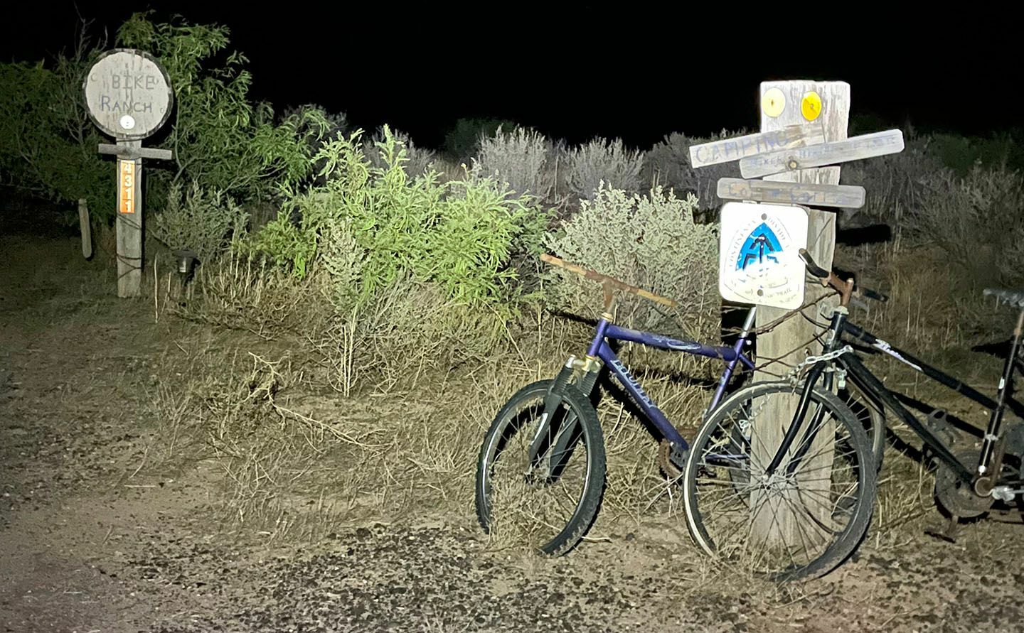
But with my arrival at the border crossing shortly after it closed, I was going to have to try to camp without shelter and wait 18 hours with no resupply and then be faced with starting my ride across a large desert portion of Mexico in the heat of the day at 10am when the border crossing re-opened, or I was going to have to scrap the idea of crossing the border at Antelope Wells. Knowing that I was not going to make it in time and with a desire to start my journey home sooner rather than later, I had already called Jeff Sharp, who runs the Hatchita Bike Ranch, to meet me at the border and take me back to his hostel. So I would simply need to find another place to cross over into Mexico.
Ironically, I was trying to cross over from the USA into Mexico, whereas the entire area was full of border patrol agents trying to keep people from making the reverse crossing from Mexico into the USA. I was stopped by a border patrol agent within five miles of the finish of my Tour Divide race to ask me whether a car that had just passed me was with me. No, it was not. As Jeff shuttled me back up to Hatchita an hour later, we saw border patrol agents arresting the occupants of the car.
A few hours later as I rolled away from the Bike Ranch at 2:45am on NM Highway 9 heading east towards El Paso trying to cross the 125 miles before the heat of the day, the roads were not deserted. I was passed fairly often by border patrol agents on duty. I guess it was obvious that I was bikepacking as they never really slowed down or stopped me all morning. Unfortunately, I was fighting an annoying headwind that really slowed my progress meaning that by the time I started to approach the outskirts of El Paso, it was almost noon and already quite hot.
For most of the morning, I was connected to a Mexican cellphone tower, and it was only as I approached the outskirts of El Paso that I finally connected to a cellphone tower in the US and decided to look at Google Reviews of the El Paso border crossing on the far western side of El Paso to see if it looked feasible to cross the border there:
- "One star is being too generous but they make you wait in line for 2 and a half hours for a 30 minute line."
- "It used to be really quick and now it's been 2 hours..."
- "If only the public knew how corrupt and poorly managed this Port of Entry really is."
These are the kinds of reviews that popped up on my phone. With it already being quite hot, I decided I would try again the next day either in downtown El Paso or the east side of the city.
Day 2: finding Mexico
By 3pm, I had checked into the hotel so I could get up around midnight and try for a much longer day on the bike, including a short out/back into Mexico. I found myself on the El Camino Real historic route passing by the Socorro and San Elizario historic mission churches in the middle of the night.
I was also scanning ahead on the phone looking for border crossings and saw a promising one at Fort Hancock about 30 miles up ahead. I made it there by about 4:30am with the border not scheduled to open until 6am. So I took my bike inside the post office and sat down on the floor to rest a bit while waiting. I woke up to the feeling of a large spider crawling across my chest. It was a wolf spider that ended up quickly leaving and chasing a bunch of insects crawling around the post office floor.
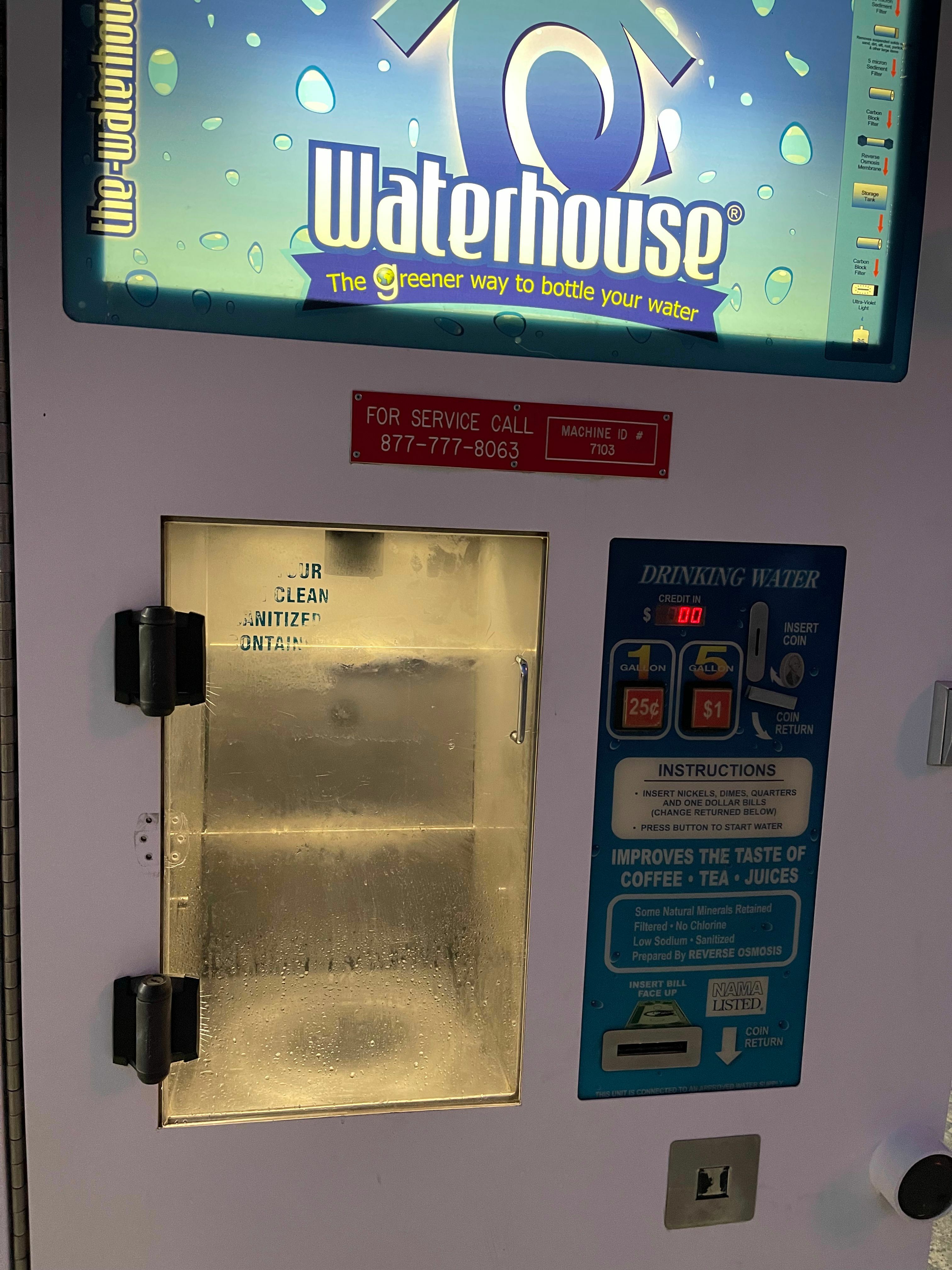 This was enough to wake me up and make me decide to ride north a few miles to the interstate to resupply at the gas station while waiting. Unfortunately, that gas station wasn't going to open before the border crossing. And, in the interest of trying to knock out as much of the ride as possible, before it got unbearably hot, I decided to use the water vending machine to refill my bottles hoping that I still had enough food to make it to the next place I could stop.
After filling up both bottles and watching the rest of the gallon just run out onto the ground, I headed to the border. Many cars passed me so I was worried that the border was going to be busy and I was going to be way back in the line. But as it turns out, most of these people must have been border patrol agents and staff working at the large customs and border patrol building. I still had my bear spray with me from the race, so I hid it in plain sight next to the road so I could pick it back up when I came back across ... not wanting to risk it getting counted as a "weapon" and me getting into trouble in either Mexico or the US.
I was the first person to cross over into Mexico. The Mexican border patrol agent said something very quick in Spanish, and I just showed him my passport. Even though I speak Spanish, I still have no idea what he said. But he waved me on and I biked several miles down the highway to the nearest town: El Porvenir. It was barely 6:15am by this point, and the town was quiet except for one Mexican police officer holding a large assault rifle at the edge of town. I continued biking on into town and then turned around at the traffic circle to head back.
 At this moment a large truck with lots of police officers carrying large guns came by shortly before I made it back to the police officer at the edge of town. They stopped and he hopped in very quickly as I biked by them. They passed me again almost immediately and turned onto the road leading to the border crossing. I was worried that they hadn't said anything because they were planning on stopping me as I tried to leave the country, but they just dropped off one of the police officers at the border and took off again.
I didn't even have to stop riding and just rode straight across the border where I was directed to the inside of the Port of Entry and spent a good 30 minutes waiting for the agents to look up things about me (I guess). I was the only one there, but it still took a really long time. They were friendly and wanted to hear all about my riding while I waited. They handed my passport back and wished me good luck riding on the interstate.
I thought that was an odd thing to say since I had routed myself near I-10 a few places, but never on it. After leaving the border patrol station and turning back onto US Highway 90 East, I found myself merging onto the interstate after realizing that I had routed myself alongside railroad tracks that had no discernible road. So rather than risk following the tracks away from the interstate and getting stuck somewhere or having to ride the tracks, I decided I-10 East in West Texas seemed to be the best option.
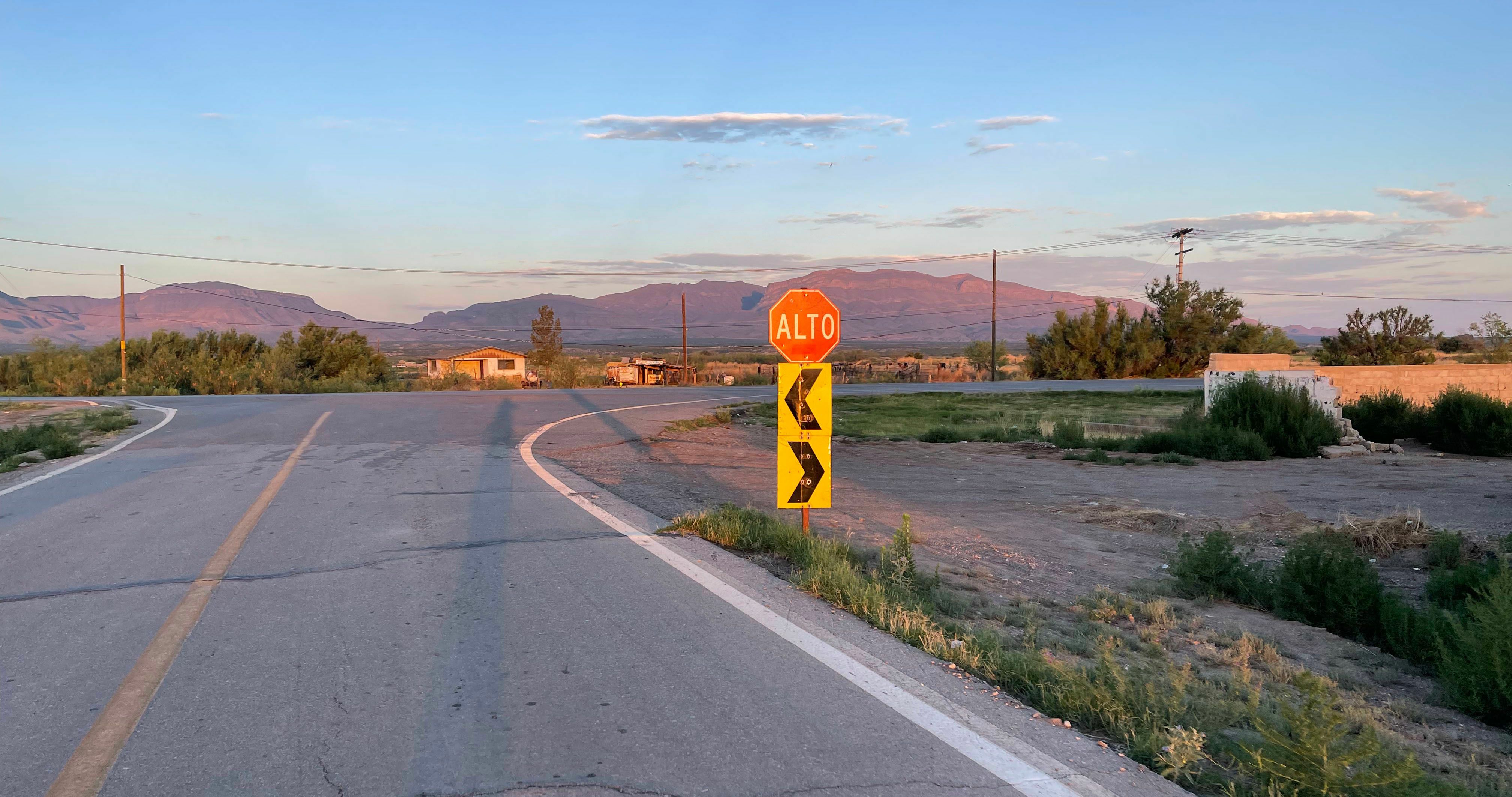
I-10 had a wide, smooth concrete shoulder with very little debris. After just a few miles, a frontage road emerged from seemingly nowhere on my side of the interstate. I rode across the grass onto the frontage road and continued alongside I-10 for a few miles. Then the frontage road crossed over to the other side continuing on for a couple more miles. But then the frontage road crossed back over and merged onto I-10, which I was pretty much committed to following at this point, since there didn't seem to be any other options. I wasn't too worried about riding on the interstate, and I was pretty sure that it was legal since there were no signs saying "no pedestrians, bicycles, etc..." But as I approached a border patrol checkpoint I could see in the distance, I decided I didn't want to take any chances of getting into trouble and decided to hop onto another frontage road that had appeared again from nowhere.
This frontage road was on the wrong side of the interstate, though, so I had to cross the median, the opposing I-10 traffic, and finally a ditch to get to the frontage road. During my crossing of the median, I ran over something sharp that embedded itself in my tire, which I noticed immediately but couldn't do anything about until I got off the interstate. I pulled it out and thankfully, after a small gush of sealant, the tire sealed itself up again. This was one of five thorns/objects I would pull out of my tire over the next few days. I'm so glad I had overfilled my tires with sealant before the start of the race in Canada.
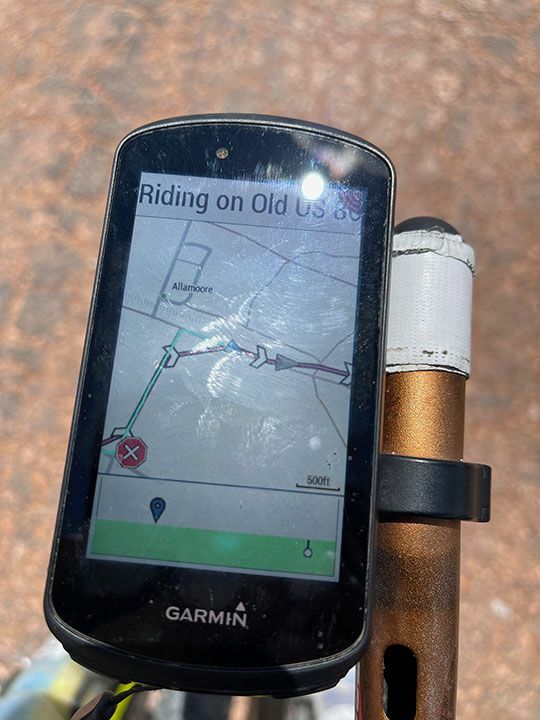
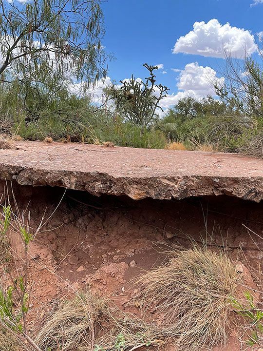
By now, I had picked up my original route and saw I was "Riding on Old US 80". US Highway 80 begins/ends in Tybee Island, Georgia, a place I have ridden my bike to many times from Alabama to vacation with my family. Also, I first met my wife while volunteering with Mercy Ships on US Highway 80 in East Texas 20 years ago. Unfortunately, I would soon find out that this portion of US Highway 80 in West Texas had long been abandoned, which led to a lot of hike-a-bike, amazingly a little bit of peanut butter mud (it must have rained quite recently), and two more thorns pulled out of my tire, but eventually I was indeed able to make it to Van Horn. At this point, I had to decide whether to continue riding through the heat of the afternoon with no shade, or stop early and start again after sunset. I opted for this latter option to maximize my time riding at night.
Days 3-5: to Uvalde via endless stars, the Prada store, but no Marfa lights
I left Van Horn before midnight under clear skies. The route slowly climbed for most of the first 60 miles on a nearly perfectly straight highway. I could see the Van Horn city lights behind me shrinking for many miles. The Milky Way was on full display, and given that I could see ahead and behind for many, many miles, I rode periodically with my lights off in awe of the stars above. I stopped once to look at the stars on the deserted highway within a few hundred feet of a large group of border patrol agents (two trucks with maybe six officers). They would have seen my little bike light for quite some time and must have been wondering "what on earth". I chuckled "oh, hello there" when I passed them almost shortly after starting to ride again.
 After another hour of slow, gradual climbing I made it to the Prada Store. I had been looking forward to this having stumbled upon it on a previous cross country drive I did with my good friend Stephen Peters on our way to the start of the 2017 Race Across America. The lights from the Prada Store were an oasis in the night in the middle of the high desert in a rural Texas county with a population density of 2 people per square mile. The lights had attracted many crickets and insects, but I stopped to rest and snap a few pictures.
I didn't stop for long because I was trying to make it to Marfa before sunrise so I could see the famous Marfa Lights. I didn't make it. I ran out of food and hit a gas station in Marfa that was quite busy but had the best breakfast tacos ever. I also didn't realize that the viewing area for the Marfa lights was several miles on the other side of town. So it was well after sunrise by the time I made it there with no hope of seeing the lights. Still, the sunrise sky on the Texas alpine mountains was fantastic.
From one of the most rural counties, I continued climbing up into the next county, which happens to be the largest county in Texas, home to the fairly sizeable town of Alpine. At this point, I was far enough into the day that it was quite hot and windy, and always a headwind. The speed limit on US Highway 90 bumped up to 75mph for long stretches. Thankfully, the shoulder was wide and OK for my gravel bike, but it would not have been great on a road bike.
The 3,000 miles of the ride was really wearing on my bike by this point. Even with a lubed chain, the bottom bracket area was quite noisy with clunking every pedal stroke. Also, my chain had stretched so much that it was kicking out of the 11 tooth cog. This was especially problematic once I made it past Alpine because the wind shifted, and I had a tailwind for several long stretches. Additionally, there were frequent long gradual downhills. With a 1x setup and a 12 tooth cog as the largest cog I could ride in, I was spinning out at 20mph, which was quite frustrating given that I should have been riding at least 25mph with very little effort.
Still, it was great to finally be past the 60 mile climb from Van Horn through Marfa to Alpine and finally be moving at pace faster than 10mph. Also, because I was either coasting or barely pedaling for long stretches, my body could focus on fighting back the super high temps which spiked up to the mid 110s by the time I finally made it to the desert crossroads town of Sanderson, Texas in the middle of the afternoon.
 There was no question of continuing on past Sanderson as riding in the afternoon heat would have been quite dangerous. My stop turned out to be fortunate, too, because I discovered after leaving again before midnight that the truck traffic was quite heavy even in the middle of the night. It went from being annoying all night to downright dangerous as I approached Del Rio. I was nervous each time a truck came roaring by with a speed limit of 75mph and many frequent hills from all the bluffs in the area near the confluence of the Pecos River and the Rio Grande. With no shade at all and small desert cactus stretching into the distance as far as I could see, the early afternoon temps meant stopping early again, but not before running into my ultra cycling Race Across America and No Country for Old Men friend Dex who saw me as I biked into Del Rio and pulled over to chat for a few minutes. It was so nice to see a familiar face after nearly 3500 miles.
I stand with Uvalde
My bike was so loud from a dry bottom bracket presumably with dried dirt and grit popping and creaking with every pedal stroke that I decided to find a bike shop. As I made my way through town, I saw "I stand with Uvalde" signs in several places. After a quick stop at the bike shop to try to quiet down my super noisy bottom bracket, I headed to the Motel 6 for an early afternoon nap so I could leave Del Rio before midnight with the aim of making it to Uvalde by sunrise.
I woke to wet streets and light rain. People were still shooting off fireworks starting the 4th of July celebrations early, but I was also surprised to see flashes of lightning in the distance as I left Del Rio. I realized that I was approaching the storms as it started to rain again in Bracketville. It wasn't raining hard, but the wind had picked up substantially and there was lightning everywhere. It was hard to read the night sky, but I felt like the storm was going to miss me just to the south as I headed east.
About 10-15 miles later, I saw lightning on the north side of the highway. Sure enough, a few minutes later the storm hit with lightning dangerously close, so I was constantly looking (and not finding) a place to get out of the storm. There were lots of high fences from seemingly endless hunting ranches, and I debated crawling through the barbed wire at one point. But instead I kept going.
A state highway patrol officer kept zooming past me and then back the other way, but other than the officer and a dozen other cars over the 70 mile stretch of highway, it was pretty deserted. I eventually made it to a highway checkpoint not long after crossing over into Uvalde County with the town of Uvalde still another hour of riding up the road. The border patrol waved me through.
By this point, the storm had quieted down, but the roads were quite wet and some of my electronics needed charging so I was thankful to find an open gas station by the time I made it into town around 5am. Already, the emotion was hitting me as I realized in such a small town that at least several people working or entering the busy gas station while I ate my breakfast tacos and charged my electronics probably knew or lost someone in the school shooting not even six weeks earlier.
Forty-five minutes later shortly before sunrise, I left the gas station to bike the final half-mile down through a neighborhood to Robb Elementary School. I started a Facebook live video a block away from the school intending to narrate what I was seeing, but the emotion cho