cancel
Showing results for 
Search instead for 
Did you mean: 
Alejandroyork
Shkhara
Status: Existing

Suggestion: offer filtering of what historic route types and speed is used to inform "popular" - allowing users to select "popular with cycling" or "popular with running" only, and ideally "minimum / maximum speed of XX kmph for the path"

This would reduce many issues with suggested routes directing users down roads that are actually inappropriate, and where known / statistically identifiable journey types have significantly different routing requirements (e.g. cycling rides will typically be longer, higher average speeds etc.) 

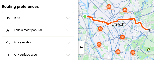
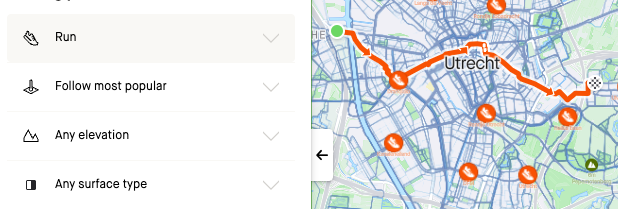
Problem: Within Build a Route - the "follow most popular" pathing does not have different data for Running / Walking vs Cycling. Most Popular is often not the most appropriate route. 

Plotting a Road Cycling route will direct a cyclist down a very popular path, popular because it is used by runners/walkers - i.e. inappropriate for cycling, creating unreliable route suggestions at best, or routes with more cycling/pedestrian conflicts, or illegal (pedestrian only) or even dangerous route suggestions (high-speed road). 

Popular but with much slower average user speeds might also not meet the road-cyclist's aims vs a nearby alternative - where better fine-grain suggestions would help immensely with routing. 


2 Comments
robbertmijn
Mt. Kenya

Ha I actually posted a very much related idea at the same time!

I was my understanding that the routing already makes a distinction between runners and cyclists.

I quickly tested this for my home town, and the routes (and global heatmaps) are indeed specific for cycling and running. 

Screenshot 2023-08-11 at 11.35.31.png

Screenshot 2023-08-11 at 11.35.16.png

Status changed to: Existing
Soren
Denali

Hi @Alejandroyork thank you for sharing your thoughts about issues you're encountering during route creation regarding speed, safety and sport type specificity. We acknowledge that our route creator has room for improvement and we greatly value feedback. We are committed to improving the functionality for a better and safer experience for everyone using it.

We utilize OpenStreetMap, an open-source project of geographical data for the entire world, alongside our own heat/popularity and other unique data, including Sport Type distinction, to help inform routing decisions. You can help the Strava community by contributing to OpenStreetMap and make edits for properties you addressed such as:

You can learn more about the Maps used on Strava, and how to make contributions, within our support article here: https://support.strava.com/hc/en-us/articles/216917717-About-Strava-Maps

If you believe there is data that could benefit from an update, we encourage you to visit OpenStreetMap to share your insights.