

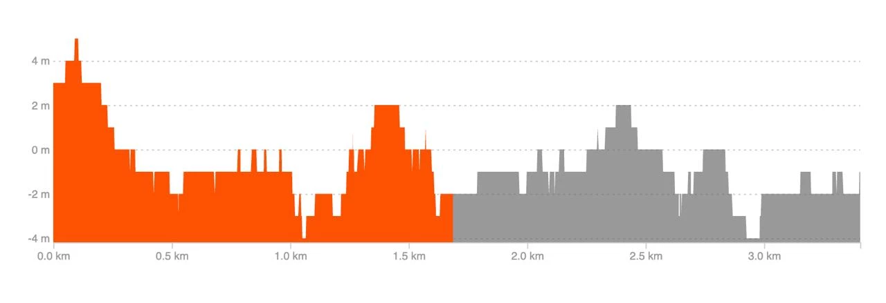
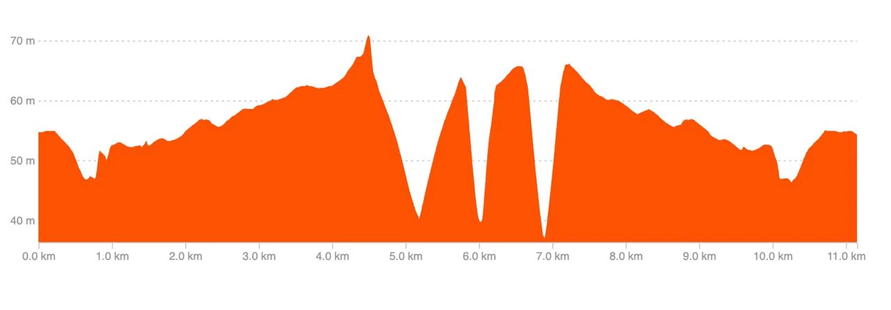
Hello,
Quick question, I have noticed that when I try to create a segment, the elevation graph is all “square” with an activity from my coros pace pro when it’s all smooth from an activity from a garmin watch :
coros :
garmin
Any idea why ? both have barometric altimeter

