
what are these weird heatmap anomalies?

  • December 18, 2024
  • 4 replies
  • 66 views

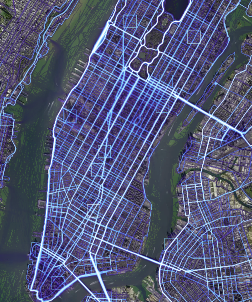
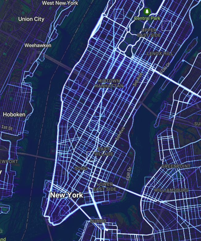
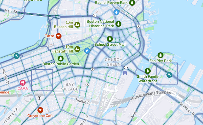
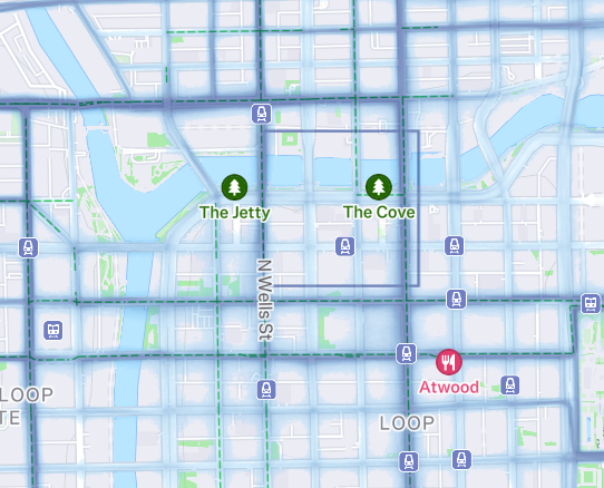
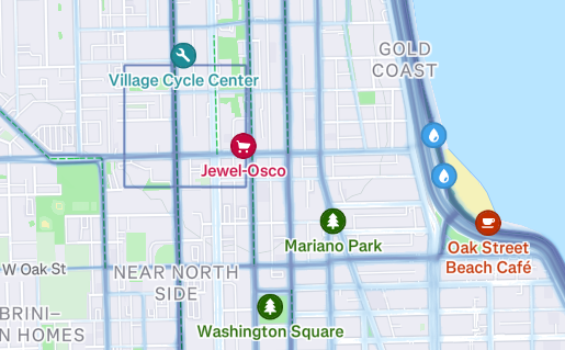
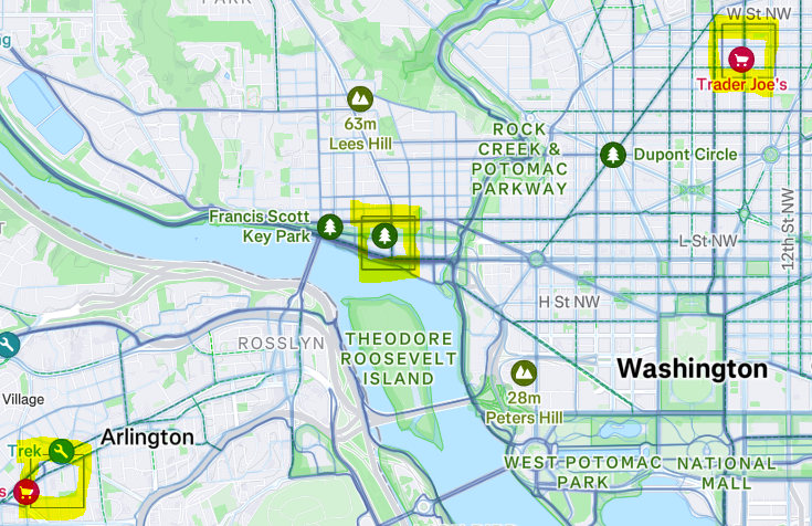
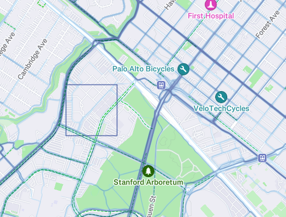
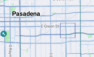
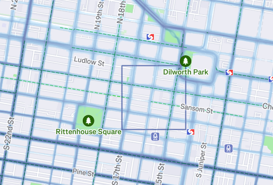
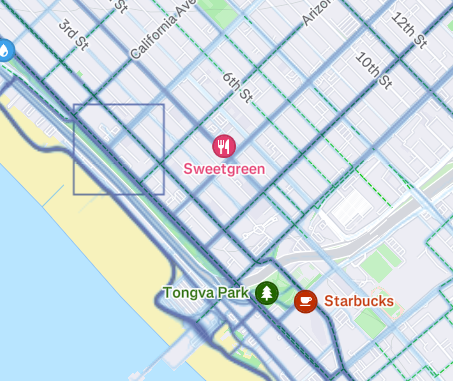
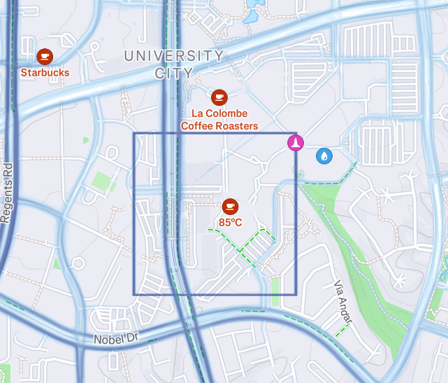
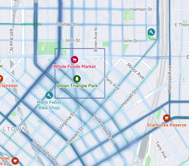
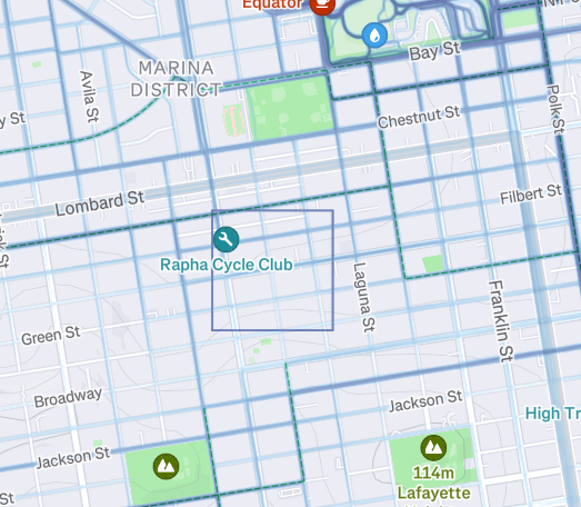
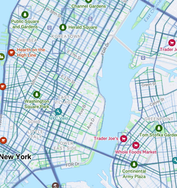
I noticed in the global heatmap in new york city, if you set the sports to “all sports” there weird squares all over the place. they are especially prominent if you set it specifically to “all cycle sports” or just “ride” only. 

they are perfectly north-south oriented, and are 0.25x0.25 miles (or 1 mile in circumference)

it does not take much to tell that there are no such routes that exist in the city. so what causes these? I’m also wondering if it’s just on my side..


Pinned reply

February 7, 2025

Hello ​@alex draves 

Thanks for pointing this out. The Strava Maps Team is looking into what could be causing those. If I get any further updates, I’ll be sure to share them here.

4 replies

Jana_S
Forum|alt.badge.img+28
  • Hub Expert
  • 497 replies
  • December 19, 2024

Virtual rides, maybe..? Just guessing though...


Jane
Forum|alt.badge.img+29
  • Strava Alumni
  • 3524 replies
  • February 7, 2025

Hello ​@alex draves 

Thanks for pointing this out. The Strava Maps Team is looking into what could be causing those. If I get any further updates, I’ll be sure to share them here.


JasperDaUnicorn

Sanity check - it’s not just you. I noticed them for the first time today as well and googled it. Your thread popped up. Very much still there!


Forum|alt.badge.img+1
  • Hub Rookie
  • 6 replies
  • April 1, 2025

I was about to begin my own thread on this, but I’ll add my thoughts here. I asked this directly to Strava support a few months ago and Bruce said pretty much what Jane did above: we don’t know.


Here’s what I deduced so far:

  • This happens on the global ride heatmap. In my screenshots below it is set to “all cycle sports”
  • The squares never seem to light up on the weekly heatmap (I live near an area with several)
  • The squares correlate with areas that have high population density, but not necessarily high activity. For example Houston, Miami, and LA have dark maps from activities but are more spread out compared with the below. Newark, NJ is considered highly dense but doesn’t have as many activities.
  • This appears to be a USA-only phenomenon; population centers internationally don’t have this. I checked Paris, London, Berlin, Mumbai, Tokyo, Taipei, Jakarta, and Singapore.
  • The route builder won’t follow them. I add this because I have seen it accept a line that’s not displayed on the basemap but is obviously the way lots of people travel.

I don’t suppose Strava devs have god mode to view all activities to see where these come from?

A small gallery of screenshots where I found these anomalies:


Boston

Chicago

Chicago

DC area

Palo Alto

Pasadena

Philadelphia

Santa Monica

San Diego

Seattle

San Francisco

New York City

(the most squares in an area I’ve found)


Reply


Cookie policy

We use cookies to enhance and personalize your experience. If you accept, you agree to our full cookie policy. Learn more about our cookies.

 
Cookie settings