Hey @bmoore235 ,
First I want to thank you for joining our Community. We appreciate athletes asking questions that others may want to know as well.
To answer your question, we work with a company called Mapbox to provide most of the actual maps that athletes see, including those that are used to draw and display Routes. You can read more about what goes into those maps here. Like Strava, Mapbox uses OpenStreetMap (OSM), an open-source project of geographical data for the entire world, alongside our own heat/popularity and other unique data, to help inform routing decisions.
I also recommend you check out our support article about Strava Maps as well.
Hi @Bryant,
Thank you for the response! Could I see the database containing the "other unique data"?
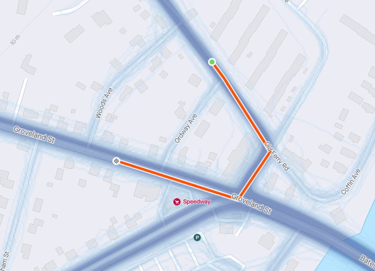
The source data from Mapbox is from an OSM Replication Feed and I was able to find this article after posting the question that says the surface data comes from OSM and "our own data on bike frames that athletes use to determine surface types on routes worldwide."
Since you are combining your data with data that is sourced from OSM it seems as if it would fall under the "Share Alike" license.
Would Strava be able to make this data publicly available?
Hey @bmoore235,
Unfortunately, I wouldn't be able to do so due to privacy reasons. However, if you do have additional questions about our maps I recommend asking our support. Please submit a support ticket and we’ll be happy to answer any questions we can!
Thank you!
Hi @Bryant,
I do already have a support ticket open, I opened it after I made this post.
I am sympathetic to the privacy concerns - and would like to make it abundantly clear that I am not seeking any individual user data. I am looking for where Strava has expanded on data gathered from OpenSteetMap. That data should be shared in accordance with OpenStreetMap's licensing.
I’d there any means for providing input to correct incorrect surface type or update “unknown “
I’d there any means for providing input to correct incorrect surface type or update “unknown “
Yes please! There are many segments and routes that contain “Unknown” or wrong surface types. Is there a way for users who have ridden the trail/gravel/road to correct or submit for correction? I usually open gravelmap.com, google street view and strava global and personal heatmaps to make longer multisurface routes. It is amazing how often surface data is wrong and contradictory on these platforms. Having the ability for users to submit a section for correction makes a ton of sense.