

Summer (in the Northern hemisphere) is just around the corner which means warmer weather, vacations, traveling, and just more time outside. Does any of the following pique your interest?
If so, we have just the article for you.
It's Chef Navi, back at it again with another article for the community. If you read my first article on Learning A New Sport When You're Older, I mentioned that I had a trip down to Patagonia coming up and I wanted to share how I find routes and trails when I travel as well as some easy photography tips you can try to impress your friends and family back home. I have split up the article into two sections:
- Creating routes
- Mobile photography tips
It can be overwhelming to do both so hopefully this journal article can help guide your next summer adventure.
01 Routes, trails, heatmap, oh my
For a time, I rest in the grace of the world, and am free - Wendell Berry
You've finally bit the bullet and paid for your airfare for a backpacking trip a couple of weeks out, or you've got that campsite reservation that you thought would never happen, or it's time to go to your best friend's wedding and all you can think of is figuring out how to take a break from all the festivities. You're not familiar with any of these places you're going to but you know you need to spend some time outside.
One of the features I use the most on Strava, traveling or not, is our maps/route creation feature. Creating routes on Strava is one of our paid features and has provided my trips with gorgeous scenery and breathtaking views. It also provides some peace of mind as you can overlay the map with the Global Heatmap and see what are the most trafficked trails which is very helpful if you’re unfamiliar with the area.
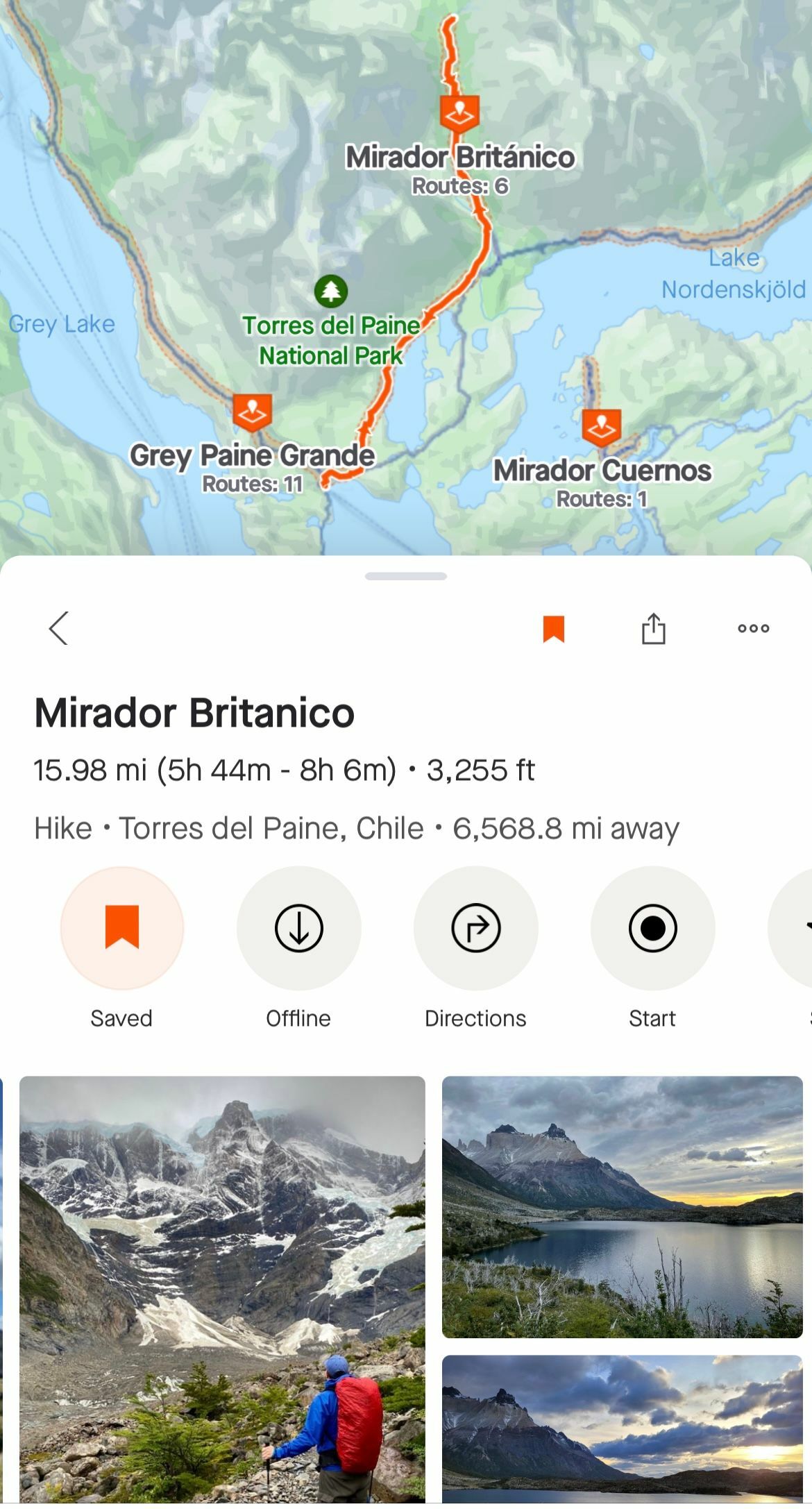
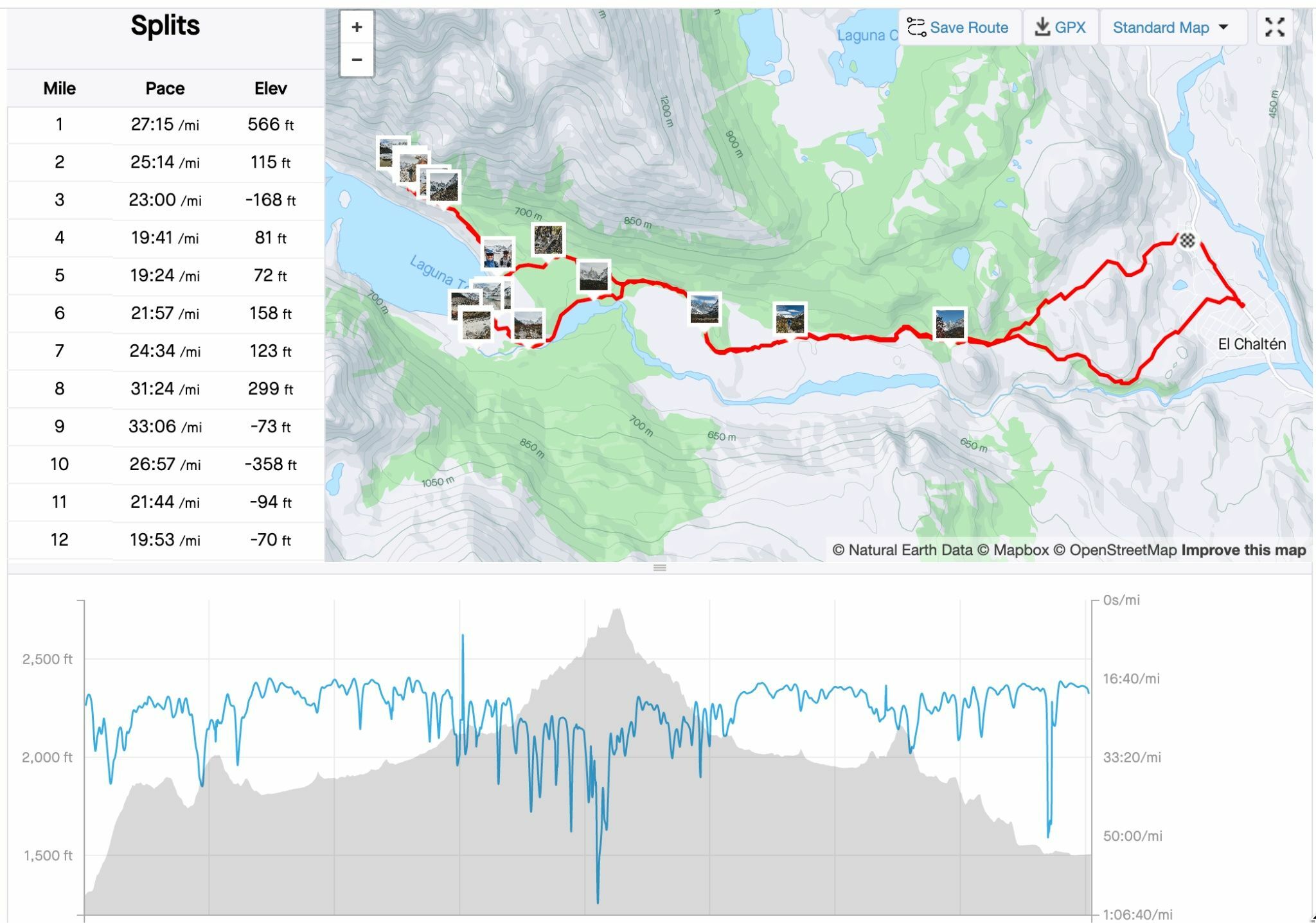
You can create routes on both the mobile app and on the web. My preference is to use my computer. The maps change based on the activity type and if you set it to hike you can see the different trail networks in the area. Below I searched one of the locations I’m traveling to in Patagonia and you can see the different trail networks.
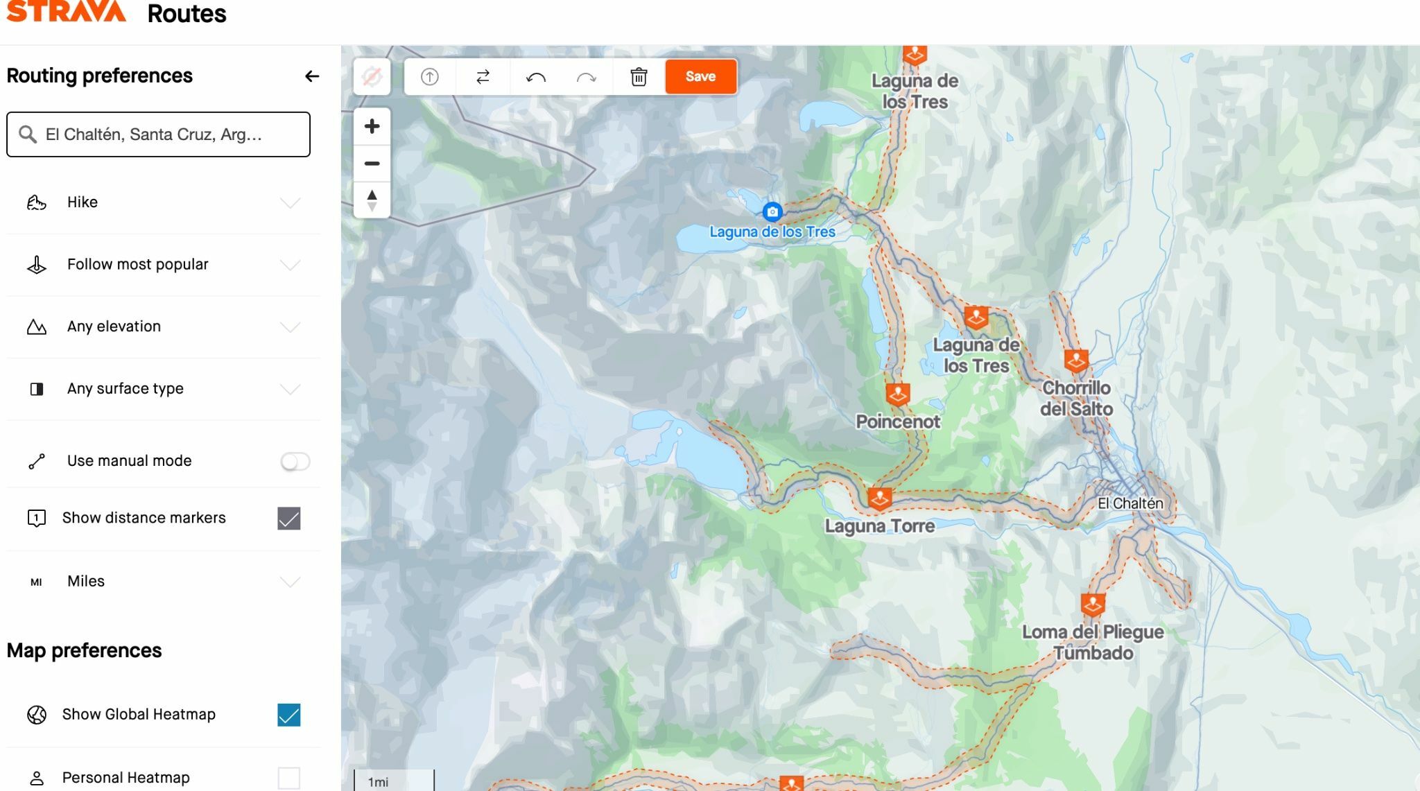
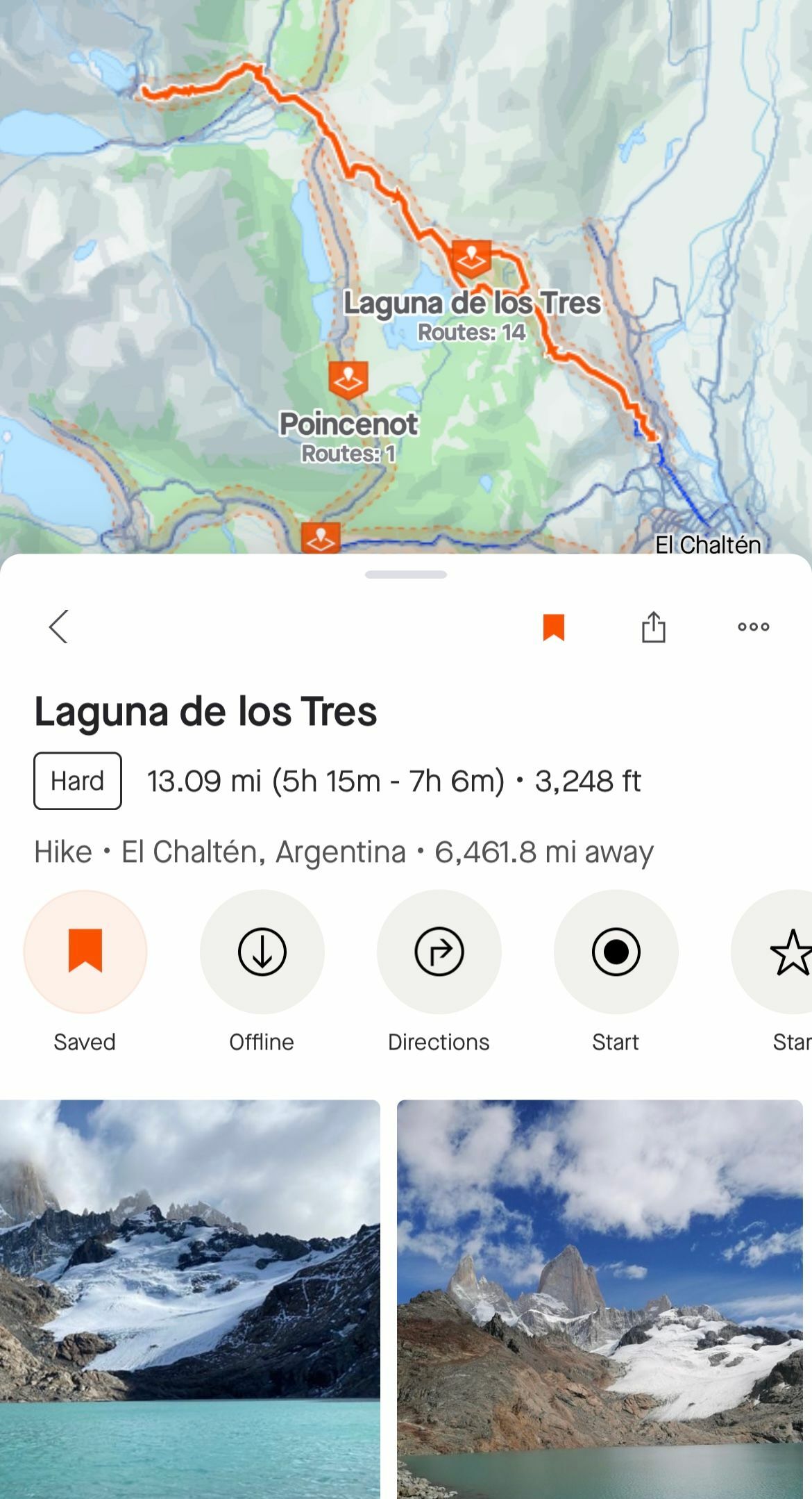
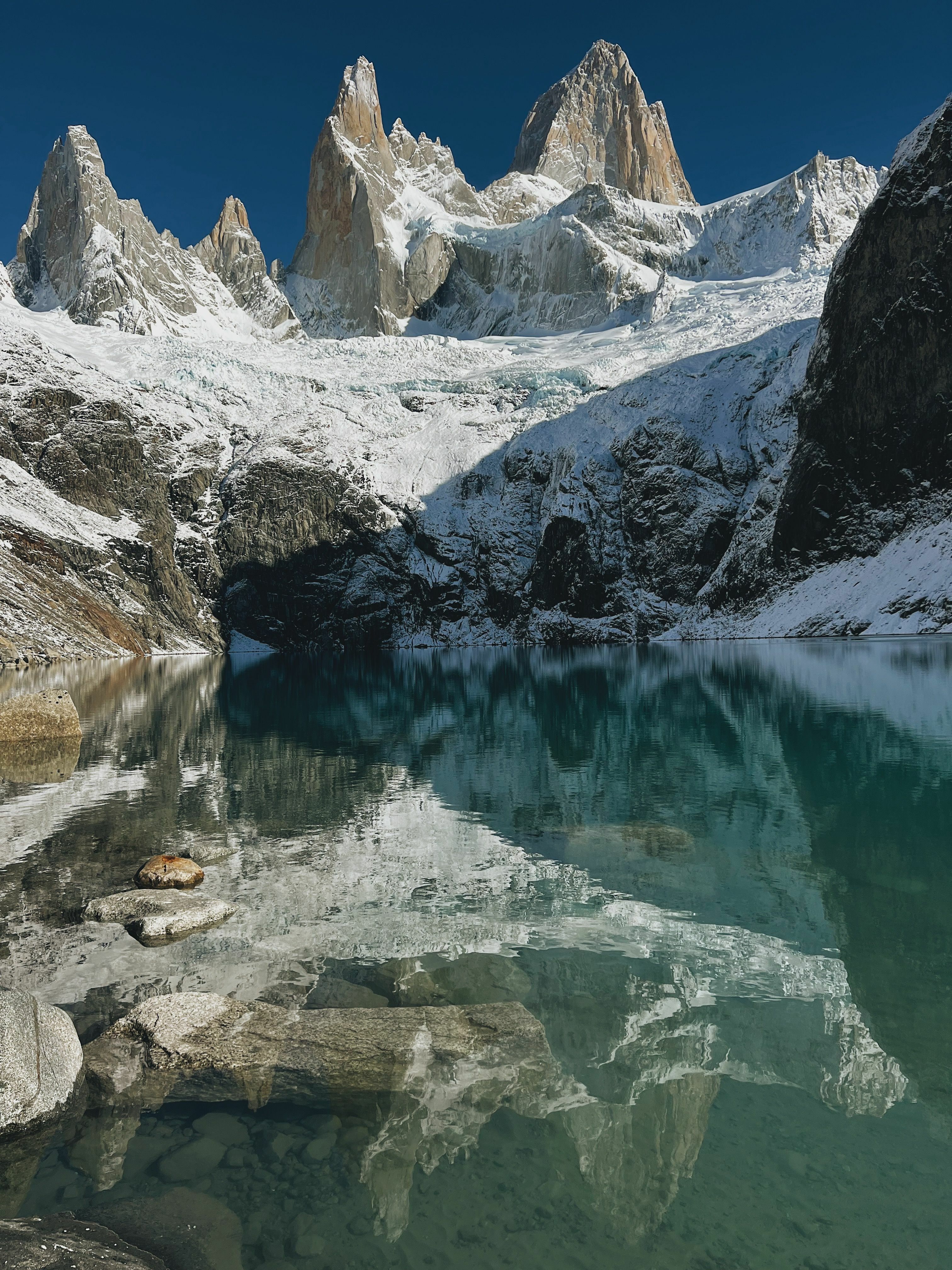
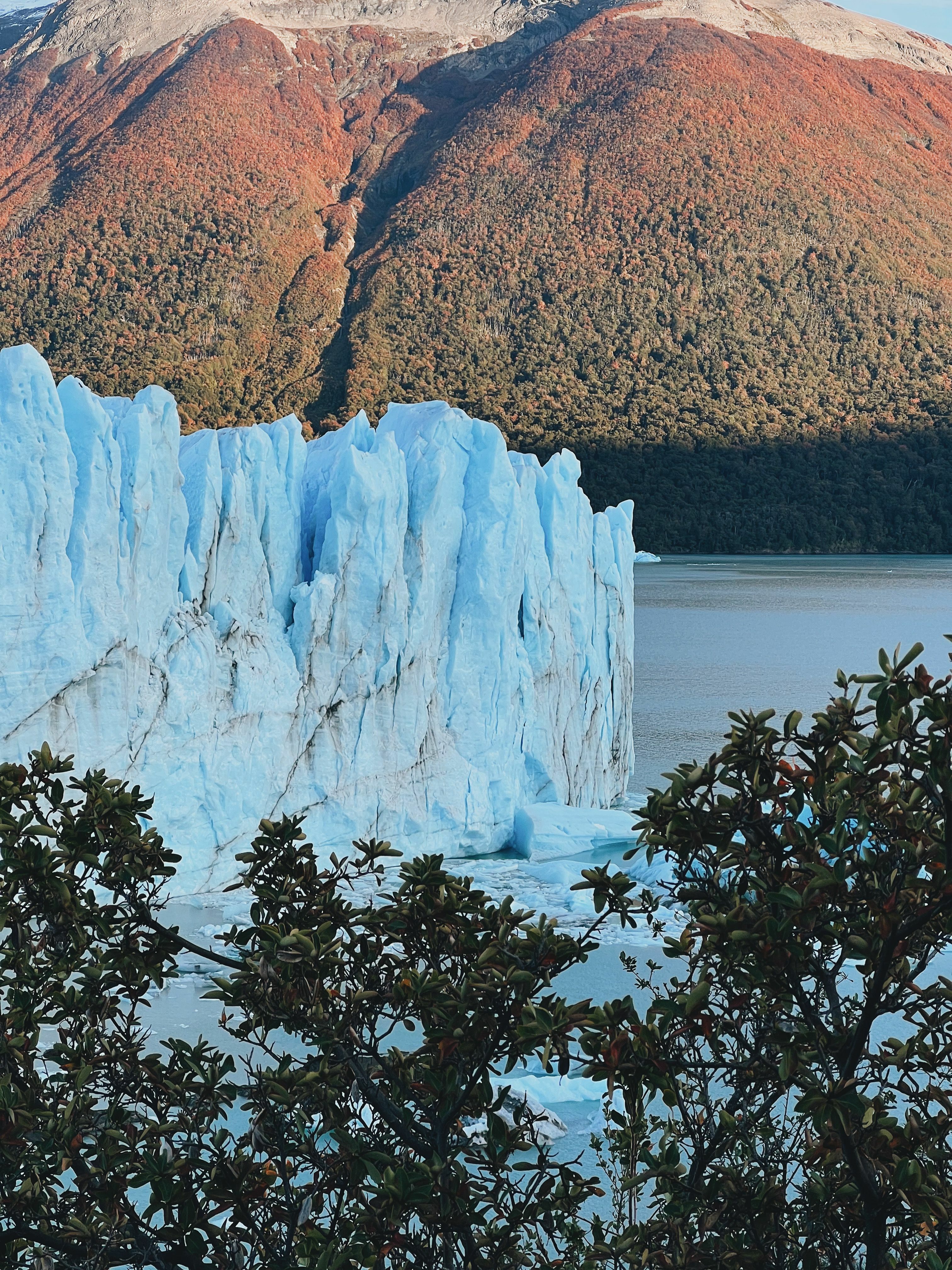
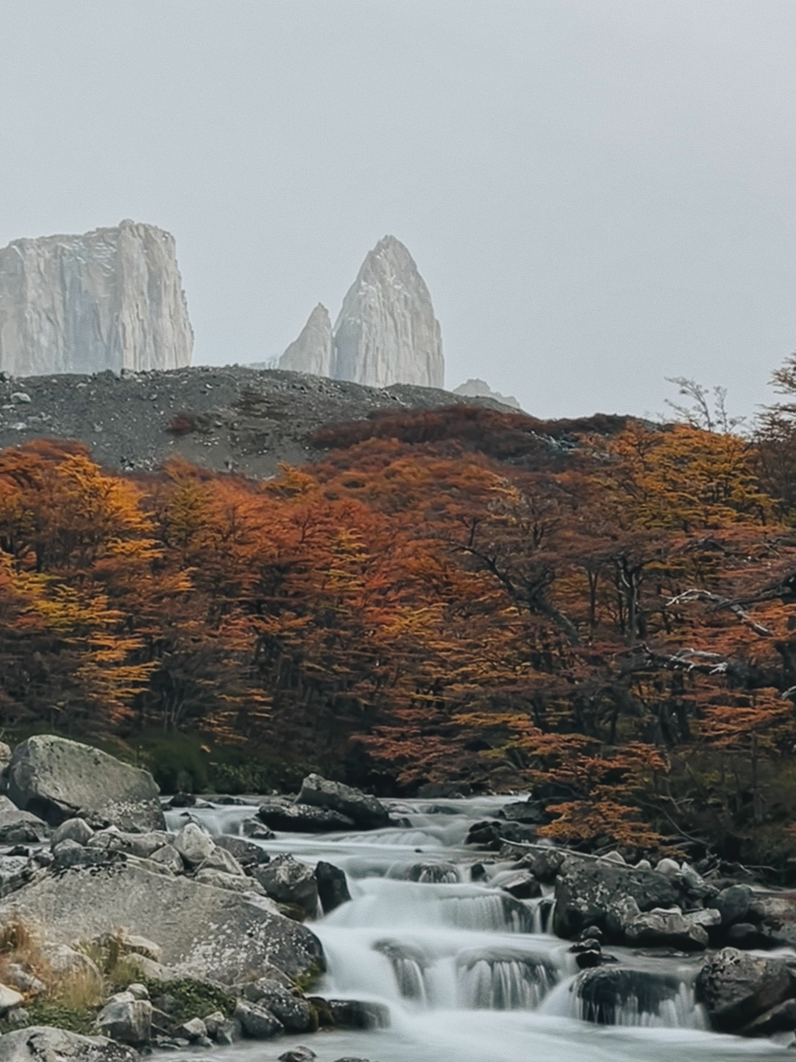
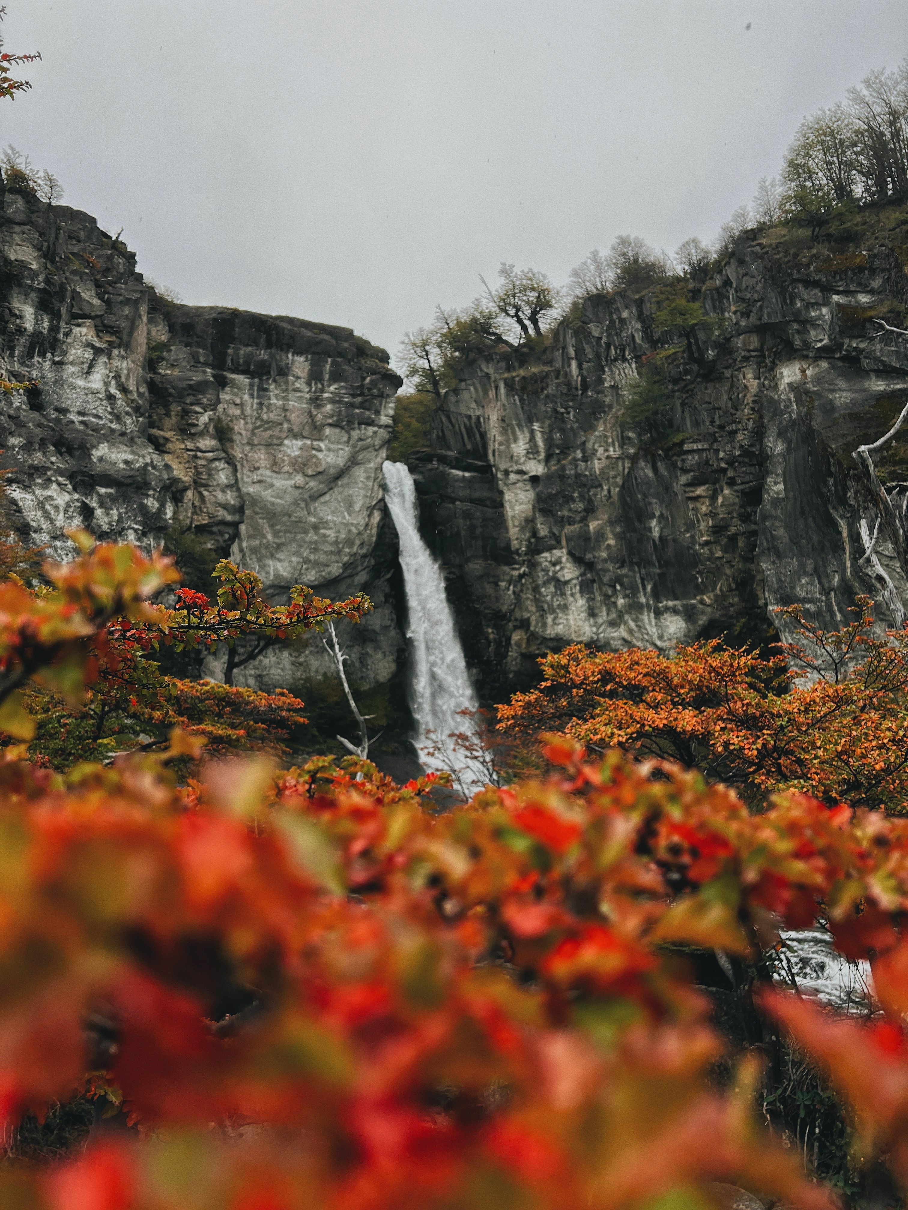
I decided on the Laguna de los Tres network as I’ve heard about this lake as it has a great view of Fitz Roy, one of the famous mountain peaks in the region. You can see in the map above the blue lines embedded in the orange trail networks. These lines are Strava’s global heatmap which is a conglomeration of other Strava users’ past activities. Here I can use waypoints to create my route starting from the town of El Chalten. One of our newest map features is Photos on Routes, where Strava includes public photos on both saved and suggested routes. These photos can provide more information on recent trail conditions, viewpoints, tree coverage, and much more, ultimately helping Strava users get a better sense of whether a route meets their needs and draw inspiration while planning their next adventure.
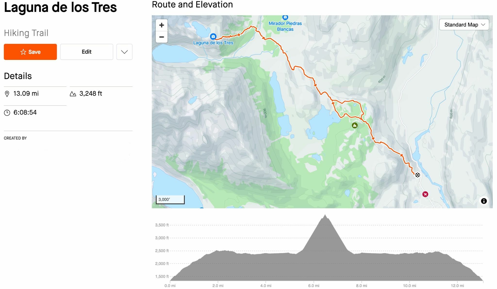
Once you save a route, it will now show on the mobile app where you can see the same details as what was shown on the web. You can also download the route for offline use which is pretty essential as there usually isn’t too much cellular reception in these types of areas. From here you can follow along as your GPS should still be tracking you along the route.
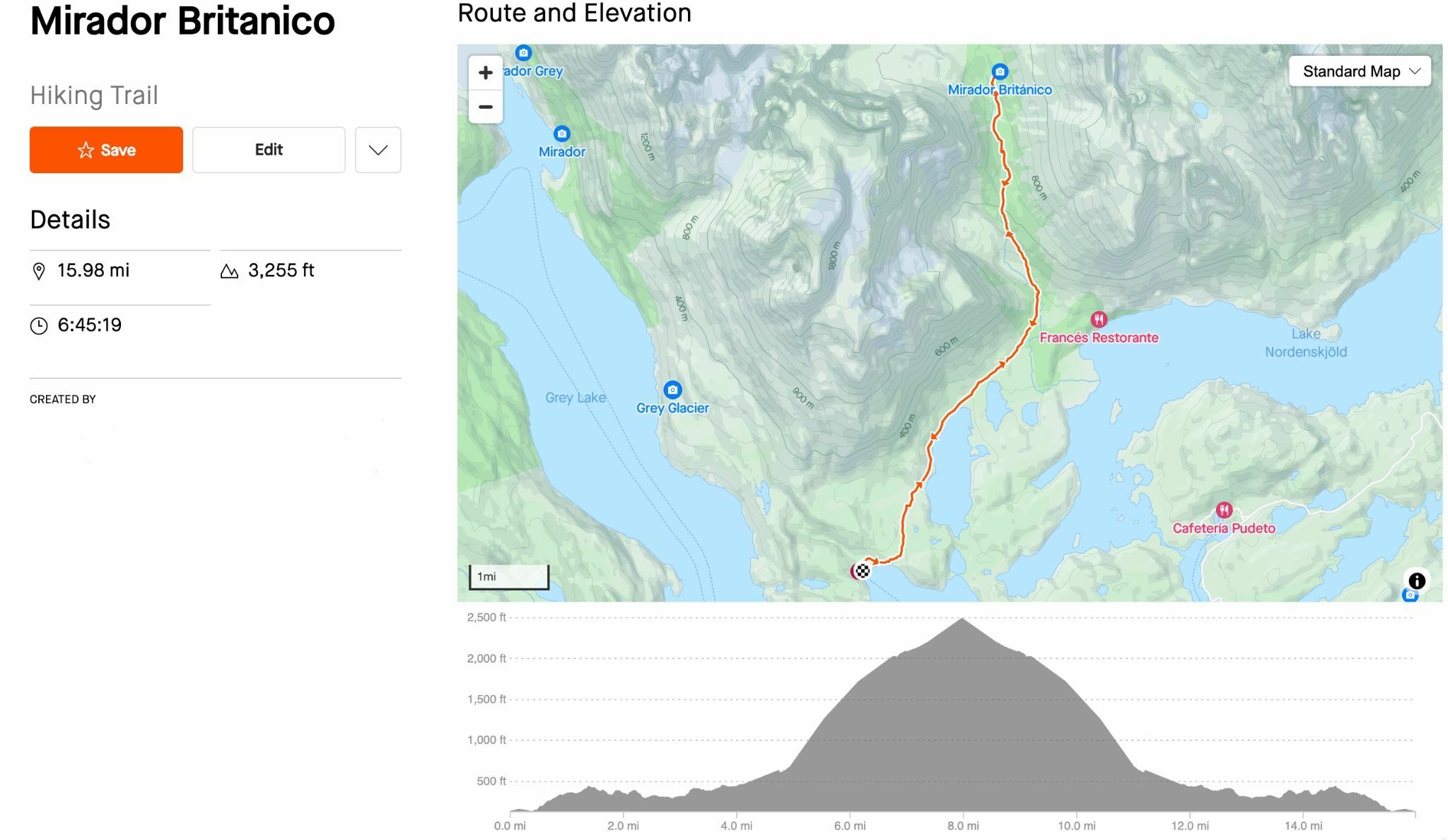
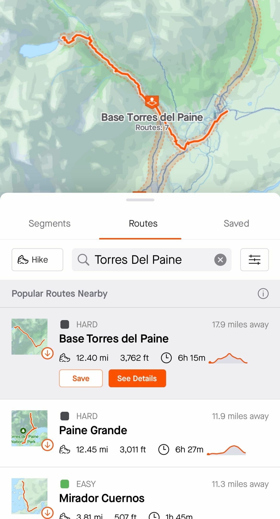
Below is another route I created in the Torres del Paine region of Patagonia along with the photos from other Strava users.
Lastly, if you’re unable to use a computer to create a route, you can use the mobile app to view suggested routes which is a quick way to automatically generate personalized routes from your location of your choosing. These route recommendations are based on public Strava activities and open-source data from OpenStreetMap.
Hopefully, these tips give you a starting point for creating your own routes on Strava!
02 Upping your mobile photography game
The best camera is the one that's with you - Chase Jarvis.
People are sometimes so blinded with having the best camera or greatest lens that they forget that the technology in our mobile devices has come a long way as well. It’s sometimes easier to pull a phone out of a pocket to grab a quick photo than to stop and remove a large camera from your backpack. Here are some tips to help bring your mobile photography knowledge to the next level.
Wipe your lens - if I had only one tip to give you, it would be to quickly wipe your camera lens with your shirt or cloth before taking a photo. Oils from your fingers leave residue after normal phone use which can create hazy photos.
Shoot from a different angle/height - We usually only see the world between 5 to 6 feet (1.5 to 2 meters) but things can look very different from above or below these heights. Try taking a photo from your hips or raise your camera above your head and capture a photo looking down. You can also try aiming your phone at various angles to get different perspectives as well.
Take advantage of the mobile camera features - There’s a lot our mobile devices can do nowadays. Most devices have more than one camera lens and the software in the phone can produce some cool effects. Try using the telephoto lens if your device has one. This will look like 2x or 3x on your camera app which is essentially zooming. Another tip is to take advantage of the live photo of motion photo feature on your device. This feature records multiple frames before and after the actual photo you want creating a short video but saved into one frame. Then, if your device has the feature, you can add a creative blur to a moving object that uses the different frames in the file. This feature is useful in flowing water which creates a long exposure effect.
Foreground and Background - At times, you can guide the viewer to focus on a specific subject while subtly ignoring everything else in the photo. This can provide an interesting representation of a moment as the depth of field plays a huge role here. You can tap your phone screen to focus on something that is close to the camera while everything in the background is blurry or you can do the opposite, focus on something in the background while subjects close to the phone are not as clear.
Filters - This is more of an advanced tip that requires a little extra time, but you can give your photos some extra love by applying edits to the photo itself such as adjusting contrast, white balance, exposure, shadows, and highlights. The native camera app is capable of performing these modifications but some of my favorite third-party apps are VSCO, Snapseed, and Lightroom Photo and Video Editor.
03 Putting it all together
The fruit derived from labor is the sweetest of pleasures - Luc de Clapiers
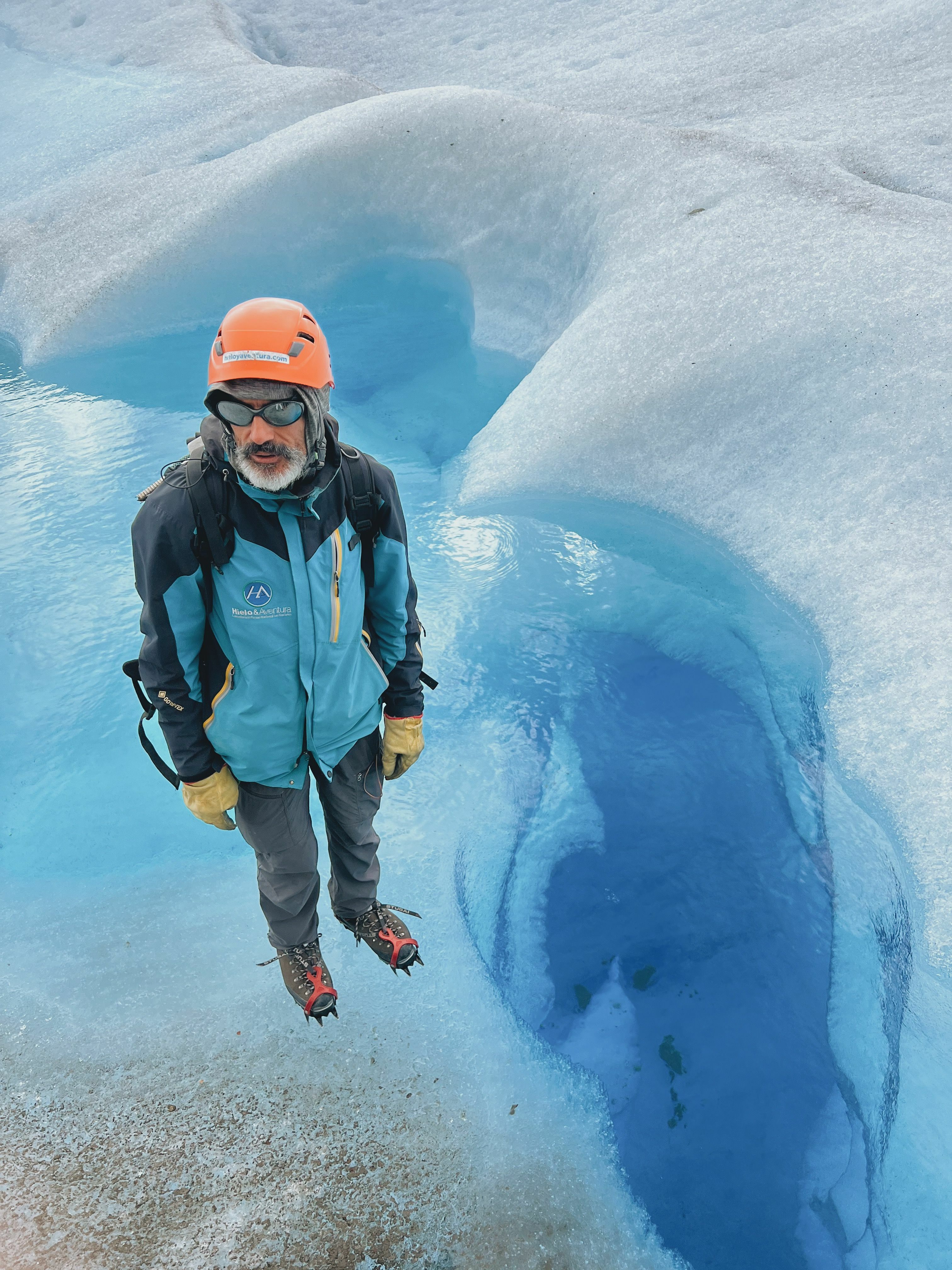
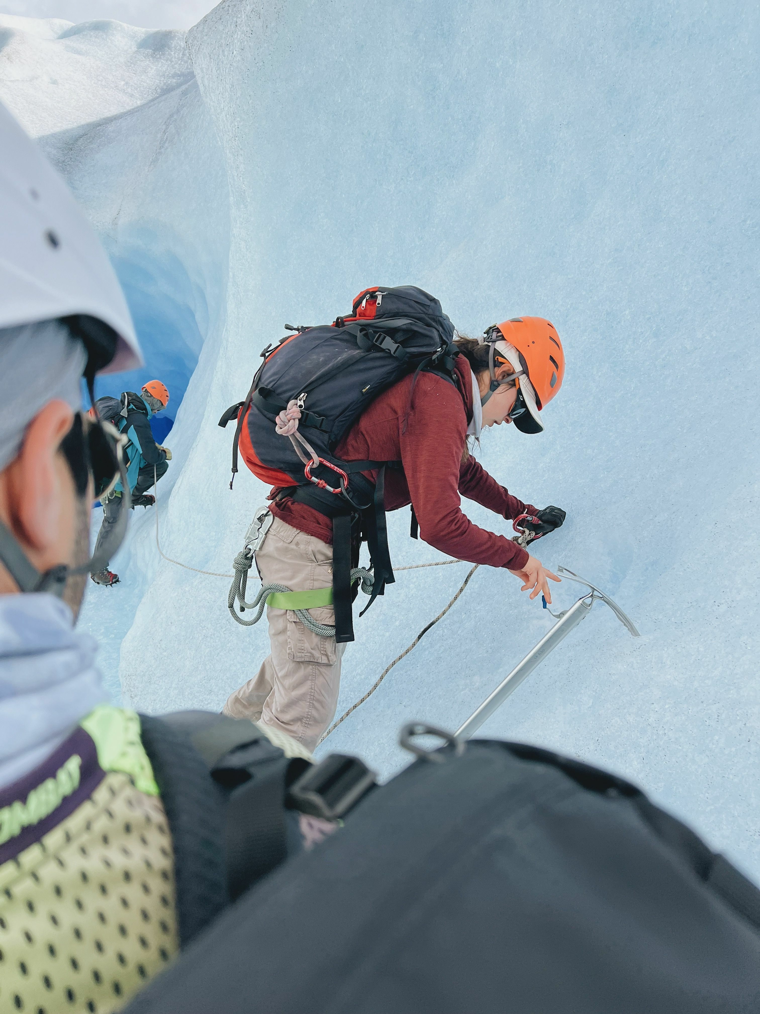
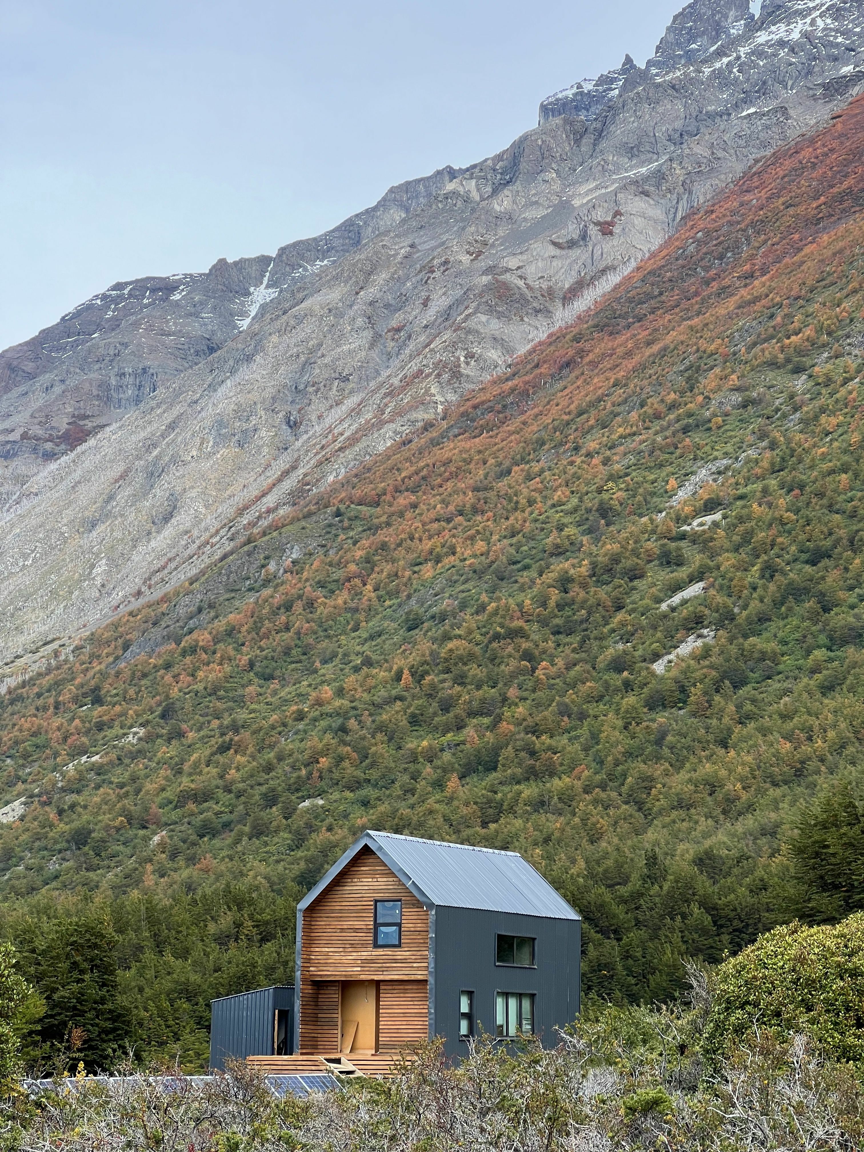
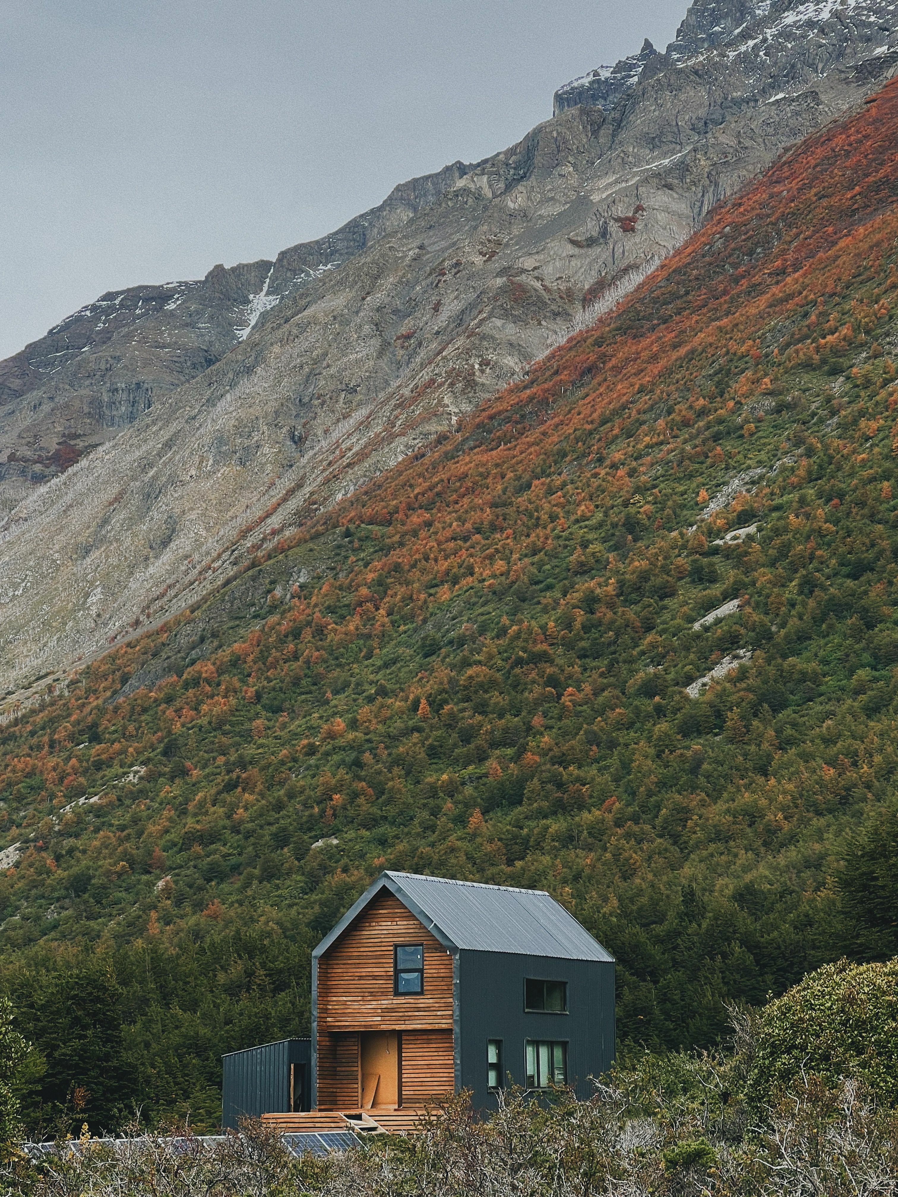
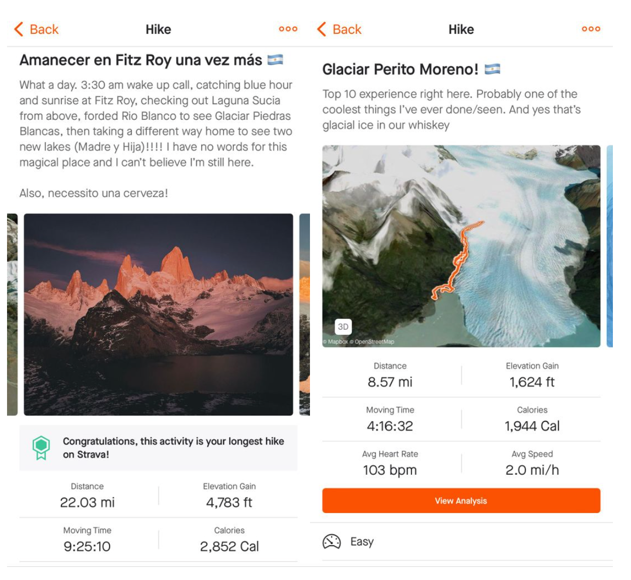
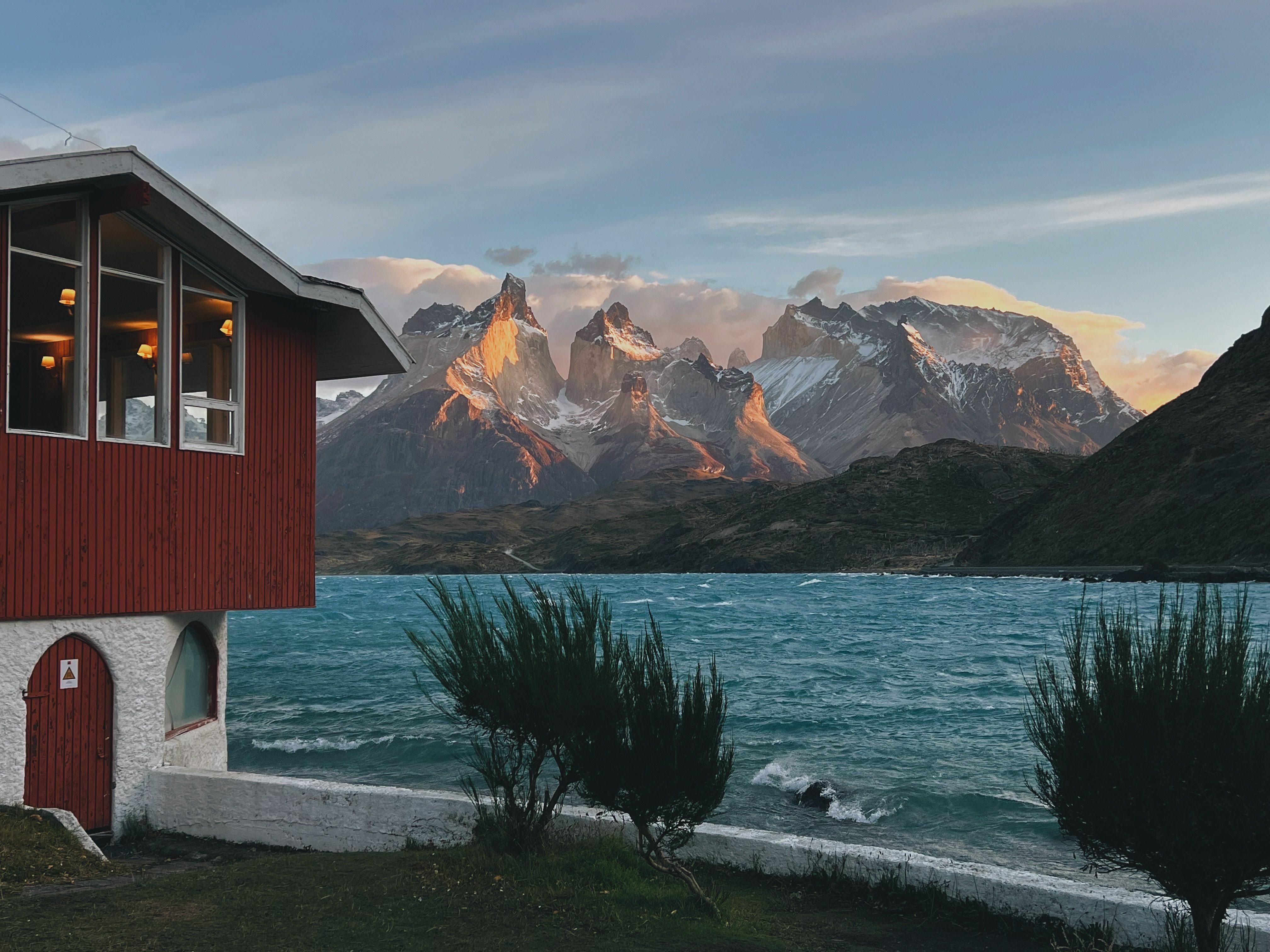
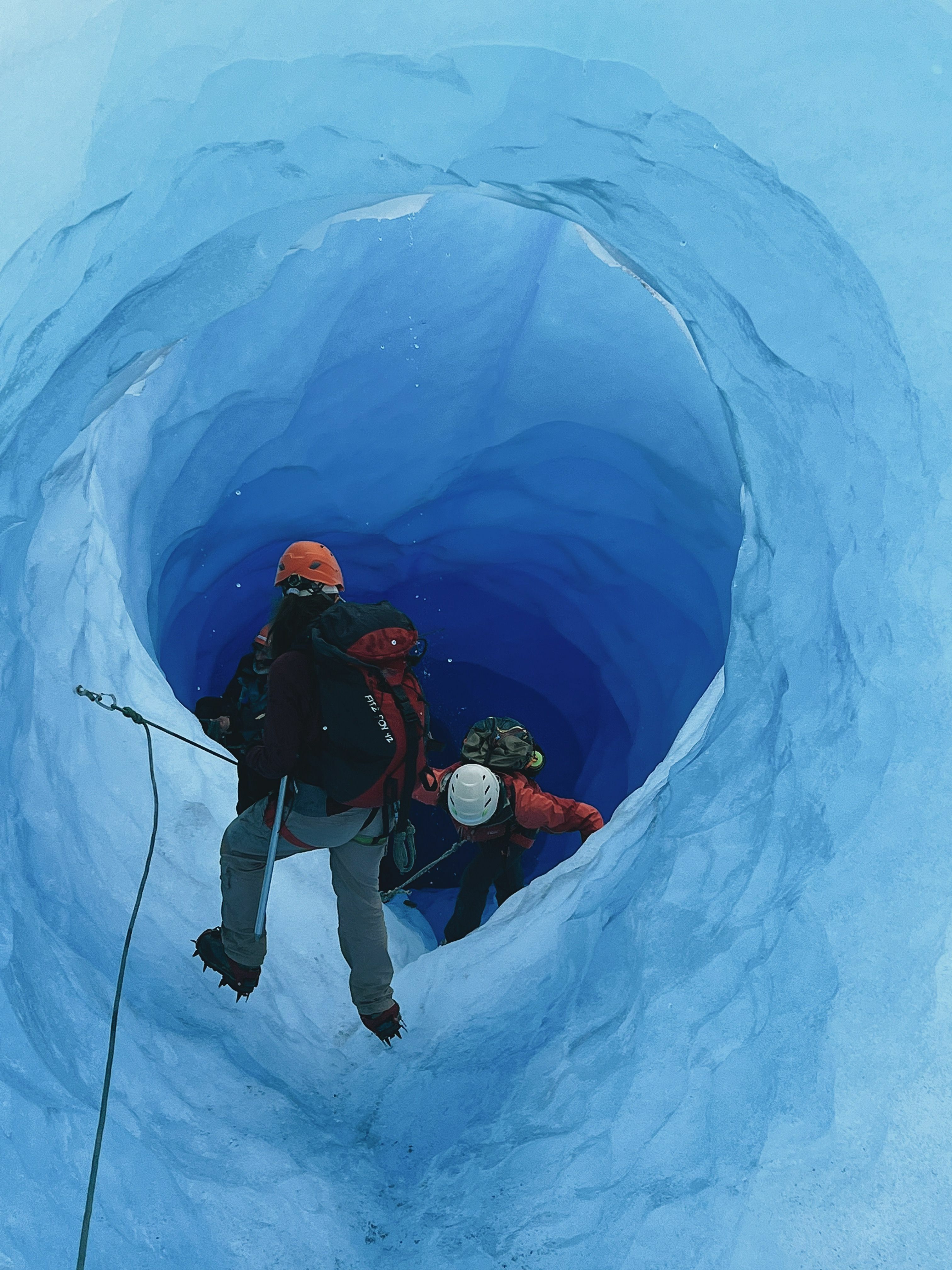
You've planned the routes. You're ready for the adventure. You're all packed up and ready to go. Now it's time to enjoy weeks or even months of preparation. I’ve included some of my favorite photos and videos from the trip as well as a few of my activities.
As Strava builds up its routes feature, you too can contribute to helping the community by adding photos to your activities. We use public photos to inspire other members of the Strava community to get out and explore. If your privacy settings allow for it, when you share a photo of a trail or viewpoint, this can help other users better understand the routes they plan on taking. Learn More.
Hopefully, this article helps you in your future travels. Whether it’s with route planning or taking more photos to remember the trip. Are you planning on any fun summer trips? If so, where? If not, what are some bucket-list locations on your list? Comment below!
For more information on creating routes on Strava, click here. For information on suggested or recommended routes, click here. For our latest news on photos on routes, check out our Strava Club post, here.
Like this post? Give it a kudos! When you like a post, it lets us know what content you would like to see more of!
Navi is part of our mighty support team. His preferred activity type is running but has really upped his cycling game in the past year (hello gravel bike). In his free time, Navi likes to travel, take photos, and try foods from different cultures as well as cooking.